|
A three-day adventure into the Northeast Kingdom
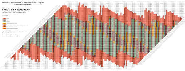
Back in 2017, I was up some random fire-road in northern Georgia, about a half-mile from the centerline of the much-touted "Great American Eclipse" as we first came to know it. While it wasn't the most ideal spot, the experience was interesting and fun, at least until it was time to drive out of the area -- when everyone along the totality path learned that when thousands of people try to drive away from a massive gathering at once, the results on the highways aren't pretty. So I had firsthand experience with many nuances of that event, and had a pretty good idea how to plan for another one. Some folks had started planning over a year in advance, but as we got into early 2024, the public hype and attention really started ramping up. Accurate prediction of eclipses has been an established science for years, and even before computer modeling people were using long tables of numbers and dates and even elaborate charts like the Saros-Inex. In this we can clearly see a certain regularity of pattern. [Images generally link to higher-resolution versions] |
|
| "Saros-Inex" chart used for predicting eclipses |
|
Eclipses occur in periods called
Saros cycles,
and the periodicity and variations within those has been nailed down
within minutes, seconds, and fractional miles of track.
So as many online resources already presented, the path and timing of totality
was already quite clear.
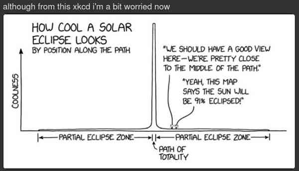
I became increasingly convinced that I simply had to get there. Because as many experienced eclipse-watchers say, "99.5% is absolutely not 100%", aptly visualized here. |
|
| XKCD on why you reeeeally want to be in the totality zone |
|
[Warning: link-fests ahead!
Javascript likely needed for many of these sites.]
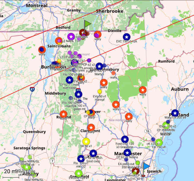
Numerous static and interactive maps were already available, so determining where I needed to head was the easy part. Northern Vermont lay at the shortest distance from me to centerline, so even though the shadow would be slightly elongated and moving faster by then, it was clearly where I should go. Less easy would be determining where and when to charge the car, and to hopefully avoid hundreds of other people with the same idea. As I had already done for much of the Eastern seaboard to support my Florida trips, I got on Plugshare and transferred a bunch of the most likely-usable charger locations onto my tablet's GPS app, so I could have my standalone "nav chart" of where to go and how to get there.
|
|
| Open Streetmap "nav chart" of many charge points and Walmarts |
|
For this trip I extended the concept a bit, adding layers with quite a few
of the level-2 "slow" chargers [in purple] and all of the Walmarts I could
find [in orange], as potential overnight boondocking spots.
Plus a rough indication of the inner two-thirds or so of totality.
My track lines are actually a little farther south than the reality, because
they were an interpolation from a sparse set of eyeballed waypoints.
Plenty good enough to show me how far north I needed to go, however.
Clearly, anyone around Lake Champlain was in for a good time!
My little ballpark destination flag, though, was in the general area of
Jay Peak, and I'll get to why there in a bit.
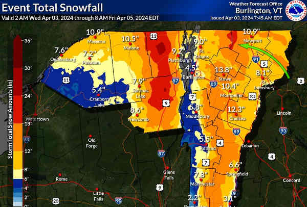
Let's just say we are *so* privileged to have all these tools available now. Electric roadtrips involve a lot more planning with online resources than in the old days, when we could just grab our *paper maps* and go. But in a way, planning each leg of the trip and knowing exactly where I'm going to find the next charger is in some way a little more relaxing than white-knuckling along the interstate with the needle near "E" and wondering where the next gas station is. The only "anxiety" in 2024 is availability of the chargers, i.e. whether they're actually working or not and how many other people might be lined up for an often scarce resource. As the time drew nearer, it was time to start tracking the weather. Two or three days out from the event, a monster late-winter storm was about to hit the entire Northeast with a lot of snow and rain. On one hand this was good, as it seemed more likely that we would have gotten bad weather "out of the system" at the right time; on the other hand, it meant that things around northern VT were more likely to be snowed in, not plowed yet, and possibly less than easily passable to car traffic. |
|
| Snowfall prediction map for the big storm two days prior |
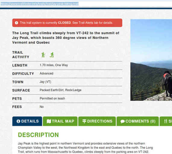
| In fact, the targeted general area around Jay Peak [green arrow above] was supposed to get another foot or more. This estimate actually moderated somewhat over the next couple of days, but the post-storm reality was that the area received nontrivial snowfall regardless. Now, how would that affect the conditions of "mud season" over the next few days? More searching around turned up a semi-official Green Mountain website with lots of details about trails and recent conditions. |
|
| The "official" word is that the Long Trail is simply closed |
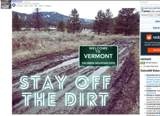
| In fact, the same site had a specific eclipse page -- by now it's partly an event recap, but at the time, distinctly warning people away from trying to combine backcountry adventures with eclipse-viewing. This sentiment was mirrored frequently in the Vermont Reddit by various locals, who had seen so many mud-season mishaps that they had entire memes about it. A lot of the rural backroads are dirt or gravel surfaces, which can readily turn into mucky death-traps for tourists and their cars. |
|
| Vermonters are really concerned about people getting stuck on backroads |
|
In the process of much more info-gathering, it was clear that some Vermonters
were *terrified* that the influx of eclipse-viewers was going to turn the
entire state into a zombie apocalypse, with food and fuel exhausted,
porta-potties overflowing, and people fighting in the streets over
resources.
Tourists stuck on backroads would be the least of anyone's problems at that
point; they could get rescued whenever later.
I found numerous documents and videos aimed at town governments, first
responders, and other officials on how to "prepare" for the influx.
Long town-hall presentations were held, telling everyone how to anticipate
potentially hundreds of thousands more transient population to deal with.
Guest speakers from other agencies described their own experiences from 2017
as a "small town super bowl like event", and tried to pass on their best
advice on handling it.
Things might have gotten a bit crowded here and there in 2017, but it never became all that unmanageable. Some folks love to speculate the worst. But the hype engine was using the lessons from 2017 to whip up even more of a frenzy about this one. It didn't necessarily help that Boston-area press had pointed to Vermont as the best option for people wanting to travel into totality. As I interacted more with the folks on that Reddit and a more general eclipse-oriented one, I absorbed a lot of perspective on how different people were thinking about the whole event. Still, I decided that I would rig the sleeper berth in full winter mode like for the usual Florida runs, pack a bunch of food and water, and stay as independent and mobile as possible. I, along with everyone else, had almost no idea what to expect. Conventional wisdom held that many people would be traveling to their chosen spots a full day before the eclipse, because they'd already booked accomodations covering multiple days -- in fact many were forced to, as lodging was commonly being offered in minimum whole-weekend blocks plus the Monday. For upwards of a thousand dollars a night! Some establishments saw the whole thing as an opportunity to gouge.
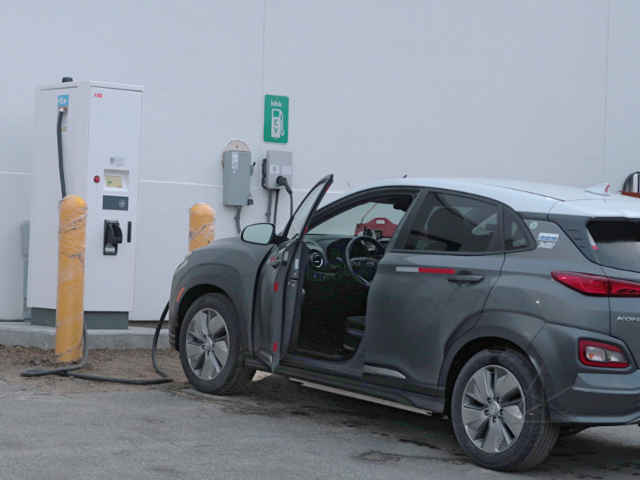
Starting the journey I packed on the Saturday evening, and took off at a ridiculous 4AM on Sunday. Again, I had no idea what to expect but wanted to get out ahead of any adverse possibilities. I could stop just about anywhere and sleep later if I had to; the entire process of the trip was left completely open and adaptable. I briefly stopped at the the Volta installation in Tilton, to see if there had been any improvements to the billing mechanisms on that set of chargers. There hadn't. They have typical debit/credit/RFID reader modules on the front, but have not been enabled to accept any forms of payment. I made a brief call to the support number and railed at them about when the HELL were they going to fix this situation, as that location is still one of the farthest-north CCS sites before the White Mountains. How any of these charging networks could refuse obvious ways to expand their customer base, is utterly baffling. I reached Lincoln and the Franconia area around daybreak, and over the Franconia notch where the road goes to one lane each way was about the only place I found any snow on the road. Whatever had resulted from the storm had been taken care of already, at least on the interstates. My first charging stop was something of an experiment just to go see another location I'd spotted in Plugshare, a single EVConnect on the side of a Chevy dealership. Nobody around that early in the morning, and my existing RFID card handily started it up. |
|
| Littleton Chevrolet completely *gouges* for charging |
|
I only found out later that this dealership had set its pricing about twice
as high as any other reasonable charging stop one might find nowadays.
Unfortunately the provisioning model is that the network only manages the
charger sessions, and site owners get to set whatever pricing they want.
It's unclear if whoever in charge of this unit was gouging out of ignorance
or malice, but I left a strongly-worded voicemail for the guy they told me
was managing this installation.
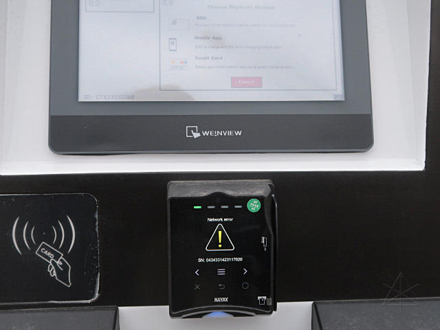
No matter at the time, though; I would get the rest of my charge farther on in St. Johnsbury, or if that didn't work out I had some route alternatives laid out that would bring me to more chargers. First, just on a lark, I went up to the Blink at the north end of town, to give it an honest go to see if they had actually developed enough clue to install something functional. I used to be a Blink customer, but later left out of sheer disgust with how they were running their meager network. Since they seemed to have a few more CCS locations by now, I figured I would give it a chance to simply accept a generic card like many of the other networks do. |
|
| Typical condition of Blink chargers: broken in one or more ways |
|
The little reader spun in the "Authorizing..." phase for over a minute,
and finally came back with "network error".
Absolutely typical of these clowns, and it seemed unlikely that their stupid
app would have worked either if I'd had it and adequate cell coverage.
So a short hop back down to the Ford dealership, and there was a pair of perfectly usable Chargepoints, not blocked in, and nobody else around. It was still pretty early in the morning on a Sunday, so I didn't expect to see anyone else around the place. |
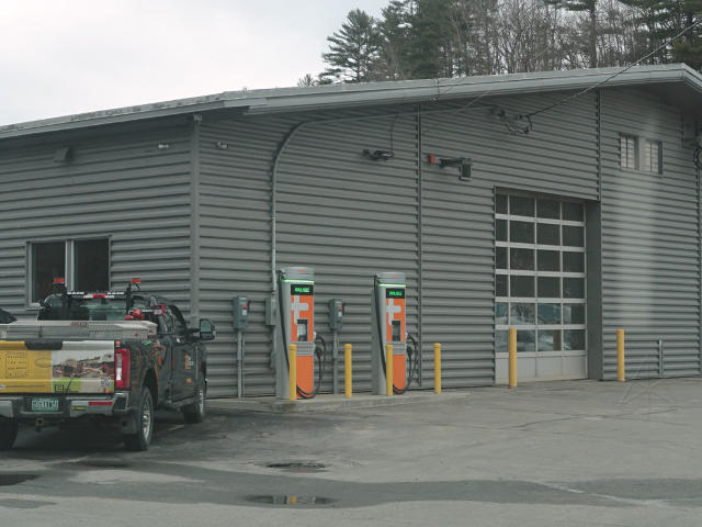
|
| Two Chargepoints, no waiting, at the St. J Ford dealership |
|
Here I would charge enough to support a reasonable amount of tooling around
the so-called "Northeast Kingdom" area of Vermont, and since this would be the
last real accessible fast-charging opportunity, the plan was then to do some
tourism and then hang out someplace at a level 2 charger to top back up for
the next day.
I was already into the totality band here, just barely, so I'd accomplished
my part-one objective and had all day to continue exploring closer to the
centerline.
This charge finished without incident, and I continued north toward Newport, which I knew would be a popular "city" destination for many other people as an alternative to, say, Burlington. Traffic had been unexpectedly light this whole way up -- I practically had I-93 all to myself all morning, and by the time I was tooling west through Derby, I was only seeing a little local activity. So much for my early fears of a massive one-day-out influx. I only half lied about St. J being the last opportunity to fast-charge -- well, it was true for me, but in theory a Blink customer could use these installed at a "Jolley" gas station along US 5. But even here, only one of the two units had power, and the people inside the store knew absolutely nothing about them other than one had never really been powered up and commissioned. |
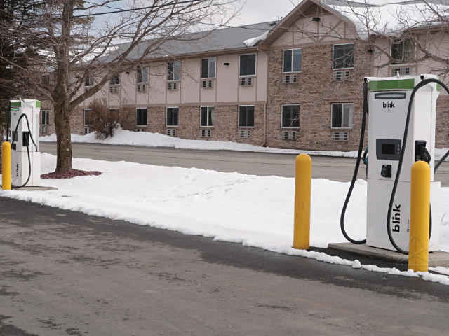
|
| Pair of Blink units in Derby (one has been dead forever) |
|
There's some evidence that a few have successfully charged at
this location,
but all Blink seems able to do is post the same canned comment over and
over.
Sorry guys, that doesn't get chargers FIXED.
Frankly, it's still easier to simply not deal with Blink at all and plan
other locations accordingly.
I continued down the road and swung into the Walmart, that's technically in Derby and not Newport, and discovered something interesting. The store and parking lot are up on a piece of decently high ground, and the western edge of the lot looks out on a good long view westward where I could just make out Jay Peak. But mostly I wanted to get the lay of the land here, as this Walmart was high on the list of places to potentially boondock for the overnight. |
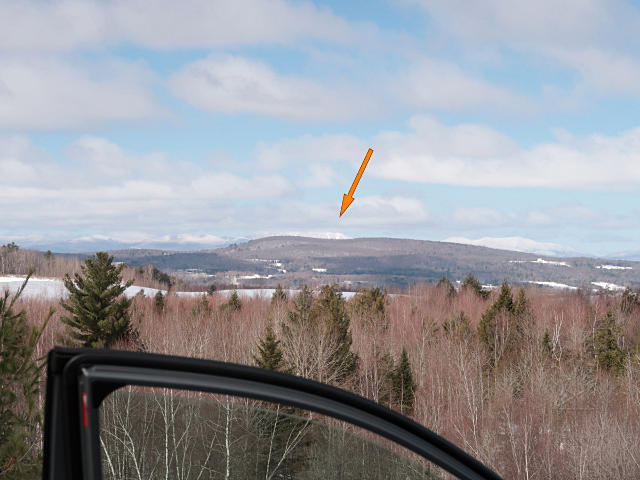
|
| View from Derby Walmart lot: nice long view to Jay Peak |
| So why such an obsession with Jay Peak? Let's back up several days. One thing I wanted to try this time was to capture the *motion* of the moon's shadow across the landscape. To do that, I'd need to be at some decent elevation with a clear view, preferably toward the west. Jay Peak itself was a strong candidate -- it's high up, has a bald summit, and a relatively short hiking trail leading to the top. But in early April the conditions there would still be quite wintry, and I wasn't sure I wanted to hang out in that for a whole day. But then I discovered that the ski resort itself was planning all kinds of eclipse-related events, including closing the ski trails around noon and then using the lifts and trams to bring lots of people to the summit [for a substantial extra fee!], thus creating a big crowded clusterfuck anyway. While the peak might make a nice hike someday perhaps this wasn't the time, so I kept looking for reasonable alternatives, using every mapping resource I could think of. |
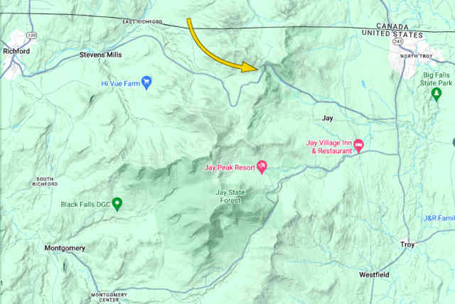
|
| Pre-survey for a good high-elevation viewing spot |
|
It didn't take too long to find a very promising alternative in
Jay Pass,
where VT 105 more or less crosses the same ridgeline as the ski resort is
on but at some driving distance away.
Visit that link and zoom out a bit for context, and note the terrain.
[Here's a
better shot
of the fire-road gate in summer.]
This spot had several advantages:
In short, some approximation of perfect for my purpose. ... Or was it? |
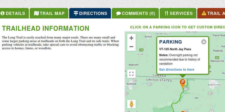
|
| Maybe Jay Pass isn't such a great place to park? |
|
In the research process I did find one sketchy note about this spot, and
eventually I sent email to the website contact address asking what
any actual experience was, if they knew.
The Green Mountain folks could not actually corroborate it; the text had
come from a note field on a waypoint in some random submitted GPX file that
the website was automatically parsing.
We agreed that it was probably from one or two isolated incidents involving
cars left there for days on end during mainstream hiking season, and likely
nothing to worry about for this trip -- even if I had decided to overnight
there, which was one of several possibilities I was considering.
So I had arrived well within the totality band and the day was young yet, and now it was time to go exploring! I tooled through downtown Newport, with a couple of stops to look at the lake and the pair of Chargepoint level 2s in a bank parking lot, and then headed out of town to do a big loop to check out the other map features I had noted in my studies. I would go out as far as Richford, a town *right* on the eclipse centerline which could be another viewing site if the locals were friendly, and then hook back via Jay Pass to check it out. Even though Vermont is a small state, distances up in these rural areas feel longer and more spread-out than they look on a map. Jay Peak loomed over healthy sections of roadway as I approached, and on closer inspection was clearly still in busy ski season. On the aerial imagery I had noticed various pull-offs around this area I could earmark as more potential boondock sites, but I quickly found that all of those were still snowed in, so it was clearly going to be someplace paved and plowed for the overnight whenever that would happen. |
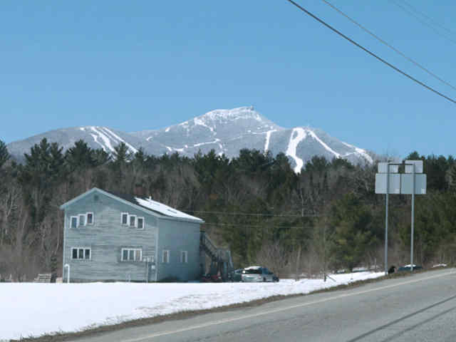
|
| Getting closer to Jay Peak |
|
At least the state highways were decently clear.
I *had* actually brought a snow shovel, anticipating that I might have to
carve out my own parking at Jay Pass, but wouldn't bother with that until
the next day if I had to.
I swung through the Jay Peak resort complex, looking for a rumored pair of level2 chargers someplace on the campus, but couldn't find them. The main parking lot was packed, busy with people obviously there to ski and shred, and of course muddy, so I didn't stick around there long but kept going south. The next surprise was the the Jay Peak trailhead parking, which was almost full! Long Trail closed my ass, there were clearly lots of people out romping in the snowy woods. |
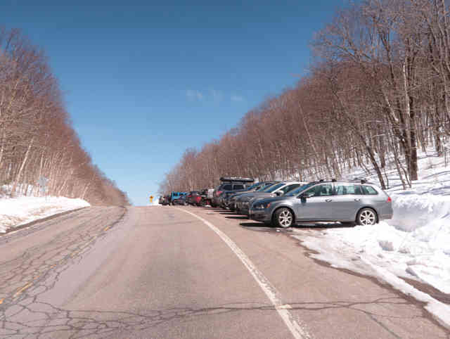
|
| Jay Peak trailhead parking was quite busy |
| Given that the trail surface was packed snow broken by many snowshoes with no mud in sight, this would be perfectly kosher to hike on, and there were no indications that any trails here were actually *closed*. Perhaps in reality, more credit is given to recreationists' own discretion on snow versus mud than the GMC website let on. |
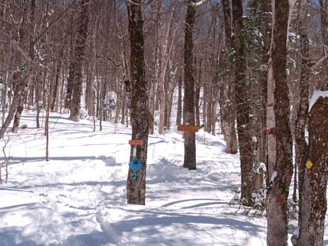
|
| Still winter conditions on the Long Trail (i.e. not muddy) |
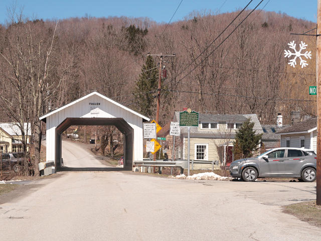
| I continued around my planned loop, through Montgomery Center and turned northward, and then got a strong feeling of deja-vu. Something seemed very familiar about this place. |
|
| Fuller Bridge: I think I've been here with the Prius |
|
On a roadtrip through northern NY/VT/NH a few years ago, I could *swear* I
had taken an almost identical picture to this with the Prius in the frame
instead.
Ransacking my old storage didn't turn up hard evidence of this, but it is
nonetheless a very cute
covered bridge,
very "Vermonty" as the google-reviews put it.
The road beyond it up the hill was a "shortcut" up to Richford, but didn't
look like it would turn into a dirt backroad so that's where I headed.
Besides, things were a little more dry down here.
Along other stretches of my loop, though, it was obvious what "mud season"
really was around here -- farm fields along the road were soggy swamps,
and you could easily spot the vehicles of locals who lived up the rural
roads from all the brown splash up behind the wheel wells.
Richford is a charming little town, and I didn't see any obvious indication that it was gearing up for eclipse traffic -- despite being *on* the track centerline. I stopped in a small general store and got more coffee, and asked the locals if they were "prepared for the onslaught". They were actually pretty excited about the prospect of having a big batch of day visitors, and didn't seem worried about it being a big shit-show of traffic and people vying for parking. The local fire department was taking up a collection along the main street, and as I dropped a few coins in the proffered boot I asked the same question; from a responder standpoint they seemed completely calm about was theoretically about to hit them. |
|
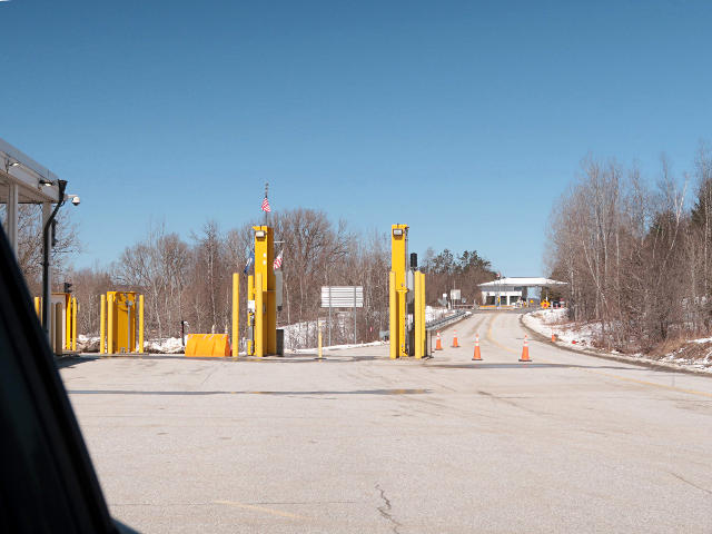
| Quick look at the Canadian border crossing |
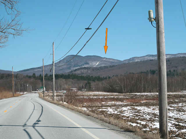
| From Richford I took a quick detour up to the Canadian border crossing just to have a look at it, simply turning around in the open area at US Customs and snagging a quick pic before heading back down. Then I got back on VT 105 and continued east, to go survey my primary viewing location at the trailhead on the ridge. As I proceeded through the lower land along the river, I realized that I could spot the noted power line cut as it came down off the ridge. |
|
| There's the power-line cut at Jay Pass! |
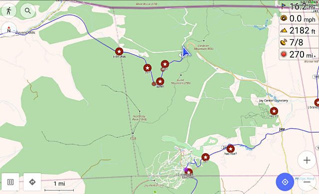
| As I usually do I was recording a GPS track of these travels, and had earmarked a few locations [in brown] where the aerial views had showed small pull-offs from the highway which could be potential overnight sleeping locations -- just little dead-end tracks a short way into small clearings in the woods. I just wasn't sure how congested everything might become the next morning, so planning some very close places to camp seemed appropriate. But at this point most of those were snowed in and completely invisible, blocked by high banks of what the plows had thrown aside off the highway. |
|
| Driving loop, including Jay Peak and briefly out to Richford |
|
My path is in blue, down into and past Jay Peak itself, off the left side
of the map to Richford, and back along 105 to the spot on the ridge.
The power line cut is even shown here in the Open Streetmap database, as a
thin white "lack of woods" line extending westward from my pointer.
It was almost surreal to finally reach this spot, which looked almost the same as it had in street-view except now with snow. But it had been plowed, so I wouldn't have to shovel my way in! I was almost surprised to find another car here, given that I had been almost alone on the highways leading up to here -- my original paranoid hype-influenced concept of busy "day-before" traffic was completely wrong, the entire area seemed to be in a typical quiet rural Sunday afternoon instead. |
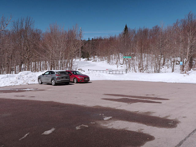
|
| Jay Pass trailhead lot: nobody really here yet |
|
And the owner of said other car happened to pop out of the woods from the
other side of the road right then, and we chatted a bit.
He had just come up to try some snowshoeing on the Long Trail, possibly
heading up to North Jay Peak or the like, but said he kept losing the
actual trail due to some combination of very few blazes and that it hadn't
been sufficiently broken by other people since the storm yet.
So he was giving up on that idea for the day, and soon left.
I walked up the road beyond the gate, first to track up the completely virgin snow covering it. The day was quite warm, close to 50F, and of course I was barefoot, enjoying some "snowfooting" which has become my favorite winter sport. On reaching the power-line, I was greeted by a satisfying long view to the west, even if only a segment of the total vista from here, but still likely all the way out to Lake Champlain and beyond. |
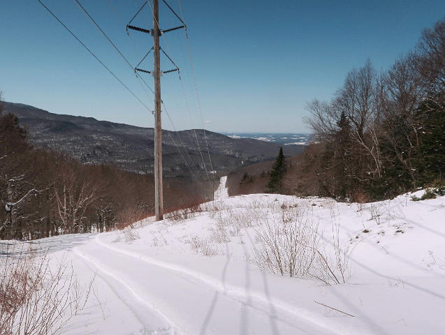
|
| Pretty nice long view westward from the power-line cut |
| Nobody else had been up here, at least on foot; there were a couple of snow-cat tracks from someone who had gone a little way down from the ridge and turned around; probably just some locals out for a fun ride. I walked down to what looked like a small rocky knob down-slope a ways, for a better view of the rest of the cut. |
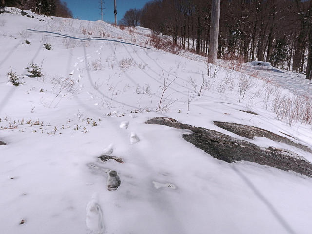
|
| Mine and a couple of snow-cat tracks the only ones here so far |
|
From here I could look back up the cut to the top of the ridge.
Anywhere along here would probably be a good spot to set up and try to
capture video of the shadow motion.
I'd brought my shovel along, and tried to clear off a bit more of the rock
so the remainder might be more melted off by the next day.
This wasn't very effective, since the snow right here was a fairly
hard-packed icy layer at this point.
With the afternoon wearing on and far less traffic already on the roads than I had feared, it seemed likely that I didn't need to be so close to here for an overnight. Besides, I wanted to get a reasonably full charge before tackling the next day, so I'd have plenty of reserve for more driving around in the process of getting back up here. As the only options in the area by now were slow level-2 chargers, I expected to sit at one for several hours before deciding where to sleep. I headed back into town, passed briefly by the chargers at the bank lot and found both of them occupied, and headed up out of town to an alternate location I'd waypointed at a Vermont Electric office. It was clearly closed on this Sunday afternoon and there wasn't much else around the area, but the chargers were available and cell service was usable, so I plugged in and prepared to hang out here for a while. |
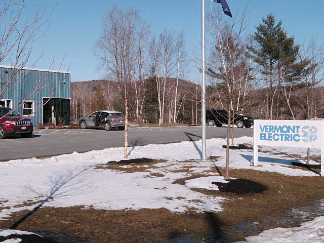
|
| Hangin' out at the co-op office for a leisurely charge |
| Since St. J and various roaming around, I was down under 50% charge, so I would be here for five or six hours. The real key thing was that I was well *in* the totality band now and didn't really have to worry about traffic anymore, and I'd have no problem passing a bit of time in the interim. I had plenty of food and water with me, and with fairly solid cell-data I could scan updated news and weather and traffic, and get back on various forums and to see how other people were describing their own trip plans [read: total guesswork!]. |
|
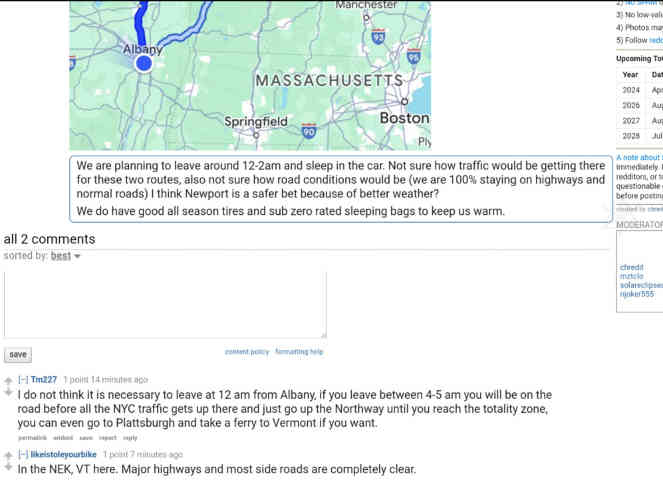
| Reddit threads about trip planning |
| Two Reddit areas were particularly useful for chatting about this -- the Vermont-specific and general eclipse-related forums. I was able to share my own progress and observations, and keep tracking what other people up here and across the country were observing as the ramp-up continued. Getting a little more invested in the hype was kind of fun, and maybe the closest I ever get to "social media" involvement in a limited way. Like any other public forum, Reddit has it share of participants who maybe aren't the brightest bulbs in the box, but on average it's been useful as an information source from people who are genuinely interested in supporting various interests. For example, I learned a whole lot about electric scooters from the topical subreddit on them, before deciding to buy my own. |
|
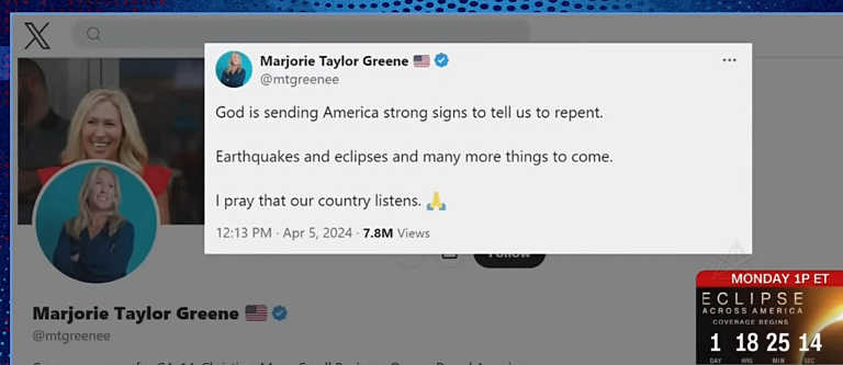
| "God-fearing" MAGA imbeciles don't understand science and nature |
|
Speaking of some seriously dim bulbs, garbage like this was being given air
time, but at least mostly via the late-night comedy hosts and held up to
the ridicule it deserved.
It's been increasingly hard to believe how those tasked with governance
of our society have not only zero understanding of science and nature, but
are actively and aggressively proud of such ignorance.
I've got news for them: anyone who is "god-fearing" cannot make any
rational claim that they are "free".
While biding time at the co-op office that afternoon I caught a brief nap as well, and sometime later a woman emerged from the office and left in the other car that was parked near the door, leaving me completely alone in the lot other than a couple of service trucks. I guess she was spending part of her weekend catching up on work. As dusk eventually arrived, my charge was just about done. Since things had been so quiet and undisturbed here all along here, I decided to simply move over a few spaces, toward the black pickup that still had snow on its hood and had clearly not moved in days, and overnight right here rather than go back down to the Walmart or anywhere else.
===== _H* 240511 |