|
Another weekend approaching, another dip into the trips database to see
if anything interesting was happening in the local AMC world that might be
worth a bit of sport.
About three entries down was an item in ALL CAPS, blasting an obvious intent
to anyone reading, and more interestingly, led by two of the most prominent
barefoot-haters in the Local Walks committee that I had ever had the
misfortune to meet and tangle with.
And that was pre-Covid, before AMC's attitude had soured even farther.
Game on, bitches! |

|
| REGI post fragment (click for full text) |
| There is only one "yellow triangles" trail in the Blue Hills, clearly marked on the DCR map. It's intended as a mountain bike route with consistent terrain, relatively few technical surprises, and easily spottable distinctive markings painted at different angles to quickly guide someone riding toward them which way to go. It's not particluarly exciting to hike on, as there's not a lot of the steep up and down that other Blue Hills trails are famous for, so it's basically a slightly bumpier equivalent of a fire road. But that's what Ken and Lisa clearly wanted to walk on today, and I figured I could go have a little fun with it my own way as well. |

|
| Baseline Yellow Triangles map |
|
Here's where a little prior knowledge of the park comes in handy.
The phrase "plenty of free parking" could mean just about one thing -- the
Houghton Pond lot, which is huge and unlikely to fill up.
And the Yellow Triangles run right past it.
The smaller lots up toward the Headquarters and police station are a little
dicey for bringing a large group in as they tend to be busy on weekends, and
farther north from there, f'geddaboudit.
So it was pretty obvious where *their* startpoint was going to be, which
was relevant for calculating overall timing.
I would go nowhere near that lot, however, and come in a different way.
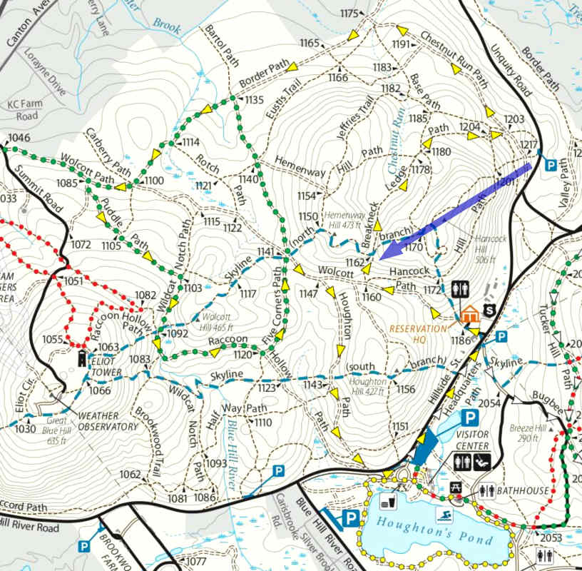
So the reason this is a long and detailed page is to illustrate the thought process in planning a maximally effective intercept route with the information given. It doesn't matter where we cross paths, the point is to simply try to make it happen somewhere. Bonus for two meetings if it's doable. The orientation of all the triangles strongly implies a counterclockwise direction, but for people hiking it really doesn't matter. Therefore, the major unanswered question was which way they intended to do the route, so I had to plan for both eventualities. Because of the nature of the players and the surrounding situation at the time, I wanted this to be a strictly opposite-direction meeting so I would be past the group and gone as quickly as possible. While overtaking might be easy and fun sometimes, it might be misinterpreted as more aggressive or something. Remember the apparent psychological makeup of who we're dealing with... |
|
| Leg 1, straight up and over Hancock Hill (phew!) |
|
The group's planned start time was 9:30, and I figured I'd give them a bit
of head start to get well into the woods.
I parked at a tiny lot farther north, and my first leg took me straight up
and over Hancock Hill, a nice steep and rocky blast right up front.
Look at those contour lines!
It was a little sketchy figuring out how the trail runs over the top, as
I suspect that people don't commonly get over this way to keep it beaten
down, or if they do it's on the flatter trails lower down.
Then I was on Skyline [blue and white], and figured on carefully crossing
Yellow but not getting on it yet.
There was a chance of a right-angle "collision" if the group was going
counterclockwise and had only reached that point, which would be sort of
suboptimal even if it might yield a chance for a halfass double meet.
The trail was clear, however, and as I kept going on Skyline it didn't matter anymore where they might be on the eastern half of the loop. I figured the easiest intercept or change-of-plan point would be somewhere along the "back straightaway" of Border Path, and routed accordingly. I'd stay on Skyline and get over to where I'd have to think harder about a possible clockwise route. Besides, I love tearing it up on the appropriately-named Skyline, the park's steep and rough rollercoaster over as many hills and big rocks as the planners could route it to. I often get very positive comments from people I meet there, ranging from "Dude! No shoes?? Respect!" to actual questions about barefoot hiking, when we'll stop and chat and I can get into some details and point people at various online resources where they can learn more if they're curious enough. Nobody I see out there tries to tell me I'm doing something wrong! At one point a largish group came at me on Skyline, which looked like it *could* have been an AMC or other type of outing, but this wasn't anywhere near where my quarry was supposed to be. I peered at the faces going by to see if I might recognize someone, or see any recognition in *their* eyes. Nope. If it had been the AMC group, that would have been a radical re-route of their stated intent. I dismissed it as some other organization and continued on my quest. |

|
| Leg 2, more Skyline |
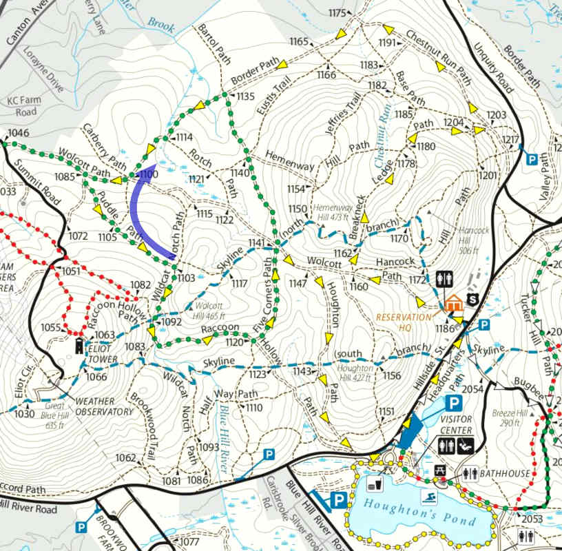
| The Yellow trail is kind of an overlay grouping of several other established trails, so leg 2 led me to the combination of Green and Yellow and up Puddle Path, a wide gravelly track that frankly would be a little tricky on a mountain bike with all the loose and somewhat rounded stones rolling under your tires. I had to check carefully if the group could be approaching me right then from Wildcat or be ahead of me on Puddle, or even coming *at* me on Puddle if they'd really ripped a counterclockwise route (unlikely), so it was all eyes and ears through the whole next stretch. Woof. |
|
| Leg 3, onto Puddle and Yellow |
| Yellow follows multiple Green segments in a weird way, but I decided to bypass the little dog-leg out to 1085 and take the shortcut across. The aggressive mixed gravel on Puddle Path was unavoidably noisy as I slammed my way up that short stretch, but then the shortcut was a pleasant contrast -- lovely soft fallen pine-needle bed underfoot, so I could go along silently and listen for any hint of group conversation floating through the trees. If the group was out in that elbow, I would maybe hear them at either end of the bypass or be out ahead of them by the time I hit Border. Or they might even be ahead of me on Border, although that didn't seem likely given that I'd gotten over here fairly fast. Didn't matter, I had a hook for all three scenarios. The only way they'd miss me from here was if they were in the dog-leg heading south, a very remote possibility and I probably would have been able to sense that anyways. |
|
| Group met head-on! Quarry bagged! |
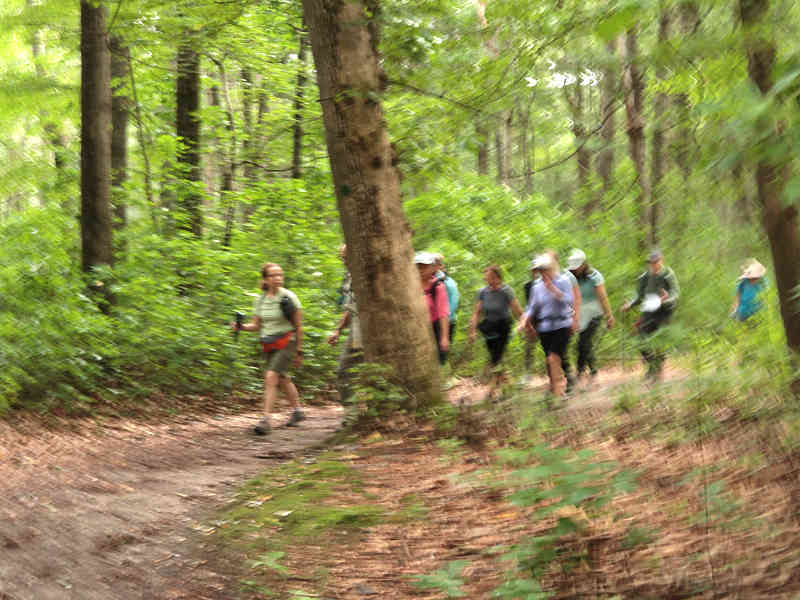
| A mere couple of minutes later, though, I started hearing a lot of voices around a curve from where I was, and sure enough, a large group popped into view, barreling right at me. Almost a jump-scare! It was clearly them, and it looked like they'd gotten a fairly full showing of participants. Hunt successful! I tried to shoot a quick picture from the hip, but it didn't come out very well. While the leader's head is mostly behind the tree here, I pretty much recognized him in very fast passing, even though I hadn't seen him in a few years. I stopped and stood aside on the convenient hummock directly ahead of me, and nodded and said "g'morning!" a few times as the rest all filed by, as it's polite for small hiker groups or singles to yield to larger groups to streamline their passage. I had done the same kind of greeting many times already that morning as I passed other people on my way, because that's the cordial thing that hikers do. I heard one lady near the back half-mumble, "oh, it's the barefoot guy!" so I'd guess she had been along on some earlier outings. |
|
| Intercept point |
|
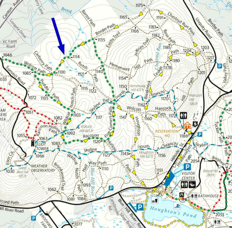
So they'd actually *almost* made the western dog-leg after all, which could
have meant a radical change in plan, and it was a razor's edge of a few
minutes of fortunate difference that got me here in time.
Anyway, they were obviously going in the direction of the yellow arrowheads.
I did a little distance and timing analysis in post, which my Open Streetmap app is great for. Time of intercept was 10:52. They were 2.3 miles in over an assumed hour and 22 minutes, giving a speed of 1.7 MPH. That's not particularly brisk, but whatever. With a later start-time I had sailed over here, about 1.8 miles, in 43 minutes, giving me an average of 2.5 MPH -- which included slower progress on a few of the big Skyline ups and downs. I should have maybe been a little more prompt on my own start time, but had been off experimenting with a rapid-charger for the car at the South Shore Mall before going for my trailhead. Anyway, the math worked out and mission accomplished. There was no time for interaction with the leader or anyone else, as we passed by too fast and he was probably in initial shock at spotting me. What might his thought process have been, though? Yellow Alert! Barefooters inbound! Or maybe just "wait a sec, is that ..." But before anyone could really react I was gone, steaming eastbound against all those yellow triangles trying to convince me to go west. It would not surprise me if he got to the next intersection and then totally lost his shit badmouthing me to anyone who would listen. For what, really, I can't imagine -- being in the woods? "Stalking"?? See the definition clarification on the main page. FFS people, lighten up. This is a harmless little game, nothing more. A "fox hunt" in whatever form it may take has been a classic outdoor pastime for hundreds of years. |
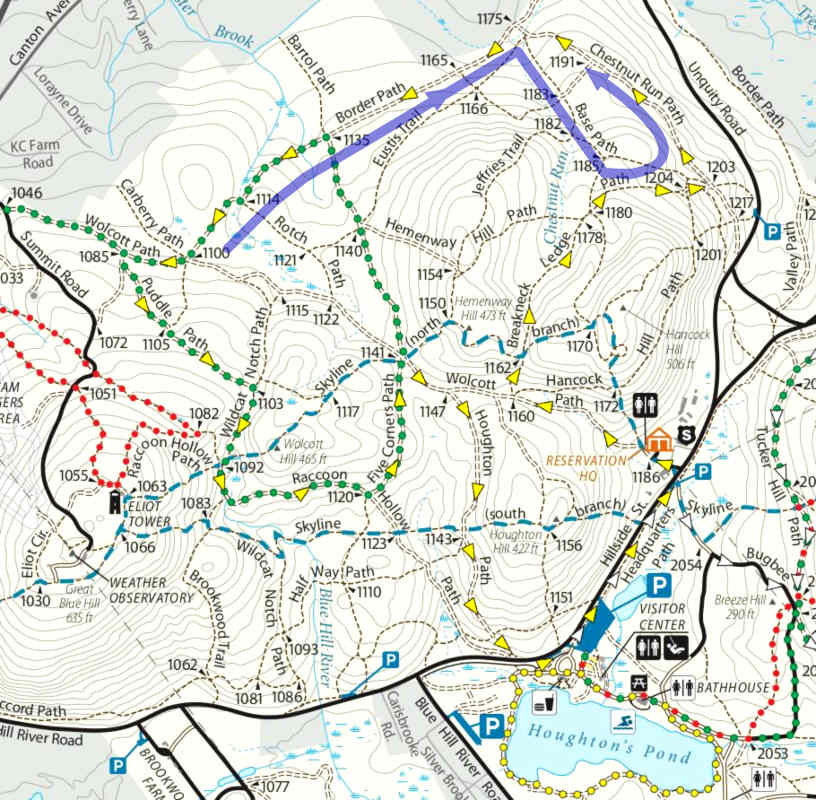
|
| Rest of proposed intercept route |
|
So basically I was done already, and was free to stop thinking about
timing and tracking and just ramble the woods some more.
I just continued up Yellow, because I don't think I'd ever been
up that way before, and hooked down Chestnut back to the car.
I didn't need to stick around, because now I had plenty of time to head back
up to the Fells and continue my project to design loops to lead its Friends
groups on over the next few months.
At least *they* seem to appreciate me.
In fact, I randomly ran into an old friend up there who was out
geocaching.
A different kind of hunt, but the same general idea and skillset.
But here's the remainder of the Yellow plan if I'd needed to implement it. I had a long stretch up Border Path that gave a good possibility of meeting a counterclockwise group, so that was pretty much in the bag if it was going to happen later than it actually did. But if a clockwise group was ahead of me, I'd have to keep looking sharp for their tail as I caught up and then quietly bail off for a fast loop-around coming the other way. If they were behind me, I'd have to get off Yellow near the end of that stretch and do a long loop-around to head *back* on Yellow as far as needed. That's what's illustrated by the big loopy arrow above. So the way this was going to work out, the group could have been a lot of different places in the park and I'd still be able to accomplish a head-on meeting *somewhere* up here. I'm sure my hike was a lot more mentally engaging than theirs. |