In advance of a Prius-owner gathering discussed here, I decided to go scope out Prospect Hill Park since I'd never been to it and it looked interesting. I was also having trouble believing that a view of Boston could possibly be had from a point that far west [it's just inside the 95/128 "beltway" at about 9:00 on the loop], especially considering that there's at least one large hill farther in, notably the one that Route 2 descends fairly steeply.
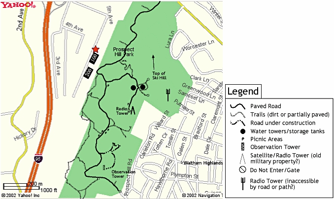
Select this for the larger map image and study it a bit, along with these
other references:
It was a gorgeous Friday afternoon, and the whole place was almost deserted. I encountered maybe 6 other cars total the entire time I was in there.
[Each image is a link to a larger copy.]
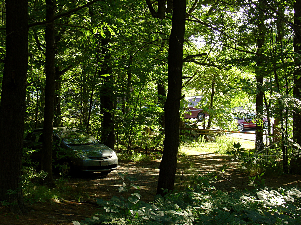
 Location 1: Entrance gate
The entrance comes up VERY quickly as you're tearing down a curved hill and can't see it approaching. There are three driveways into the parking lot, so if you miss the first one you can recover and still turn in, but the actual beginning of the park road is waaay over at the right-hand [west] end of the lot.
Totten Pond Road apparently tends to pack up a bit with rush-hour traffic,
when this was taken, but normally it's a typical pedestrian-hostile
impatient-yuppie-infested semi-major thoroughfare where anyone trying to
navigate and slow down to find something is given the hairy eyeball and NO
quarter to do so.
 The road ascends fairly steeply along the western edge of the park, and soon
passes right behind the nest of corporate buildings that most people probably
think is the "Prospect Hill Park" they see from the highway. You'd never know
there was a real and very nice park behind it all. Picnic sites are scattered
throughout, but I can't understand why anyone would want to use this one in the
shadow of the "executive suites" instead of one farther in that's surrounded
by woods??
The road ascends fairly steeply along the western edge of the park, and soon
passes right behind the nest of corporate buildings that most people probably
think is the "Prospect Hill Park" they see from the highway. You'd never know
there was a real and very nice park behind it all. Picnic sites are scattered
throughout, but I can't understand why anyone would want to use this one in the
shadow of the "executive suites" instead of one farther in that's surrounded
by woods??
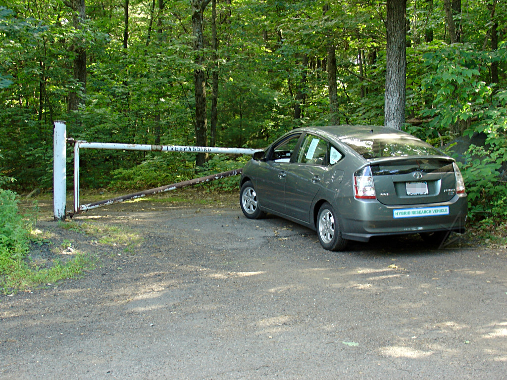
 Location 2: corporate parking lot non-access
Just before the turn away from corporate-land, there's a little gravel offshoot and a gate into the back of one of their parking lots. That's my car, crouching stealthily in the dark, mysterious woods, ready to leap out on some unsuspecting Porsche. Actually, some guy came out as I was taking this and got into the red Beamer seen here and left, blathering on his cellphone the entire time.
The gate is pretty firmly locked preventing car access, but a pedestrian or
bicycle can freely go in and out here.
 Location 3: water tanks
A short way later is the major fork. I decided to left-hand-tour it. Soon
I arrived up at the old water tanks. Well, they *look* old; I don't know
if they're still active or not.
 Location 4: Oops!
Continuing the left-hand tour didn't get very far, and fetched up against
another locked gate. Fortunately there's also a little turnaround. Now,
does the paint [or lack thereof] imply that trespassing is encouraged,
or ...? The path beyond here supposedly leads to the Mystery Radio Tower.
There's a Knox box attached to the gate post, implying that the fire
department has access to it.
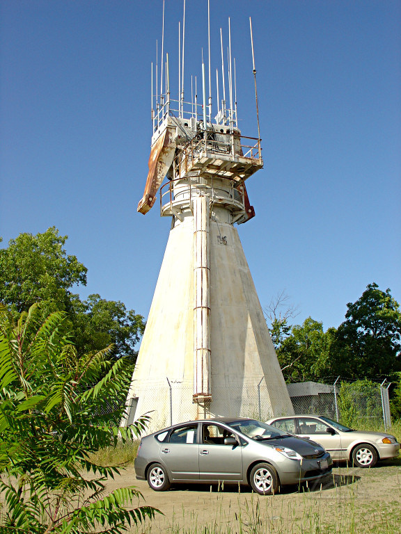 Location 5: Radio tower
Up a little from the tanks is the top of the first hill, and this very weird thing on top of it -- also shown as a teepee type symbol on the Yahoo map. The tower may be old, but that's a forest of quite modern antennas on top, so it's clearly still active in some manner.
This is another dead end. There's a very small gravel area around this, that maybe 6 - 8 cars could park in if they squeeze creatively or a couple more if they don't mind being blocked in. And there are too many trees around for a good view eastward without hiking a ways into the woods.
I also talked briefly with the couple that arrived in the other car, who told
me that parking does get a little hairy on busy days -- the small number of
official lot spaces fills up fast, and people just park wherever they can
along the road. There are no signs anywhere about it either way, so I guess
it just works itself out in a reasonable enough way that the town hasn't had
to intervene and impose restrictions yet. The only signs I found were on
the various gates, asking that they not be blocked.
 Location 6: Picnic pavilion at "Big Prospect"
As I was coming back down from the radio tower, I pulled in next to a black
Classic also parked here! I figured maybe it was Ichabod or some other local
also scoping things out, but it wasn't. The couple that owns it was just
leaving, in fact, so we chatted and I handed them a flyer and told them what
I was up to, the existence of Priuschat, etc etc. In return I was handed a
small "one less SUV" bumper sticker and a couple of those bright orange
"violation: earth" fake tickets one can drop under SUV wipers to try and make
a point. After a little research it appears that I had just met up with John
Tagiuri, a local artist and the major mover behind
Earth on Empty.
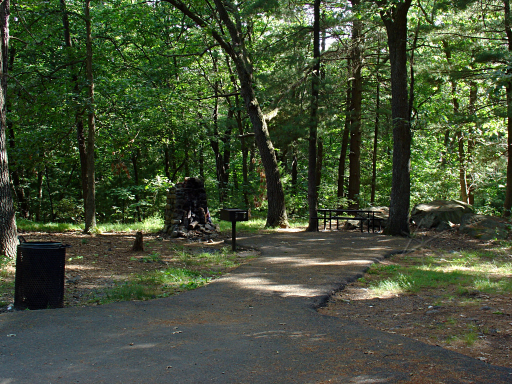 I returned down to the Major Fork and continued southward. This is one of
the many little picnic areas along the road. They usually have the funny
stone cairns designed as fireplaces, and a reasonable amount of flat area
which one could possibly pull a couple of cars into.
I returned down to the Major Fork and continued southward. This is one of
the many little picnic areas along the road. They usually have the funny
stone cairns designed as fireplaces, and a reasonable amount of flat area
which one could possibly pull a couple of cars into.
Not too much poison ivy around, but there is a little here and there.
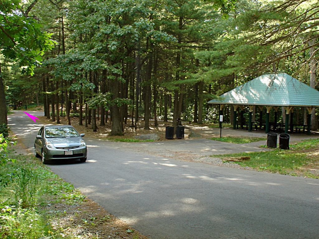 Location 8: The "far turn"
The southermost extremity of driveable road, looking southwest. The pink arrow behind where my car is points to yet another gate that bars access to the "emergency road" that exits the park at the southeast corner. There's another large picnic pavilion here, and another small building off to the right that I thought might be restrooms but doesn't actually seem like it.
In fact, I didn't notice any restroom type facilities anywhere, which might be
a problem for extended park stays. On the other hand, there are lots of woods.
But just because I didn't spot anything doesn't mean there aren't any -- I
didn't actually think to look too hard until a little too late. There may
be something in the group of buildings near the entrance parking lot, but
it might be better to call in and ask.
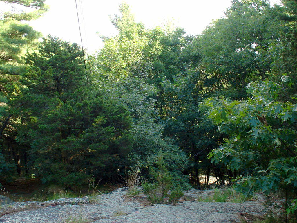 A short way off the Far Turn is a large rocky outcrop, below which the rest
of the "emergency" road can be seen snaking around to the east. There doesn't
appear to be an observation tower here anymore, but a few steel rods and bolts
remain driven into the rock which were probably its underpinnings in the past.
A short way off the Far Turn is a large rocky outcrop, below which the rest
of the "emergency" road can be seen snaking around to the east. There doesn't
appear to be an observation tower here anymore, but a few steel rods and bolts
remain driven into the rock which were probably its underpinnings in the past.
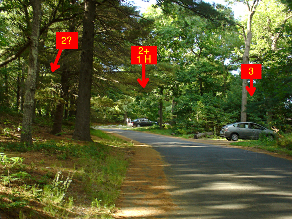 Location 9: Top parking?
[oops, motion-blur noticed far too late to retake it...]
Up the hill a little more from the Far Turn [heading north, now] are a couple more parking areas, but very limited. The labels indicate number of marked slots, and in a pinch, a couple of cars might be able to slot into an unpaved flat area to the left.
There's a flattish grassy area off to the right of the farther black car,
which also might serve as a gathering area and also as more parking if people
drive *very* gently on the grass. But doing that may be looked on with some
disfavor regardless, especially if other park-goers want to use it as a lawn.
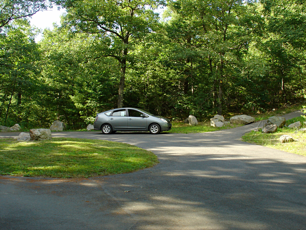 Location 10: the loop
The road ends near the top of "Little Prospect", in a small loop around a
grass island. A few cars could probably squeeze around here but it's not
marked as a parking area [but again, no signs saying No Parking, either].
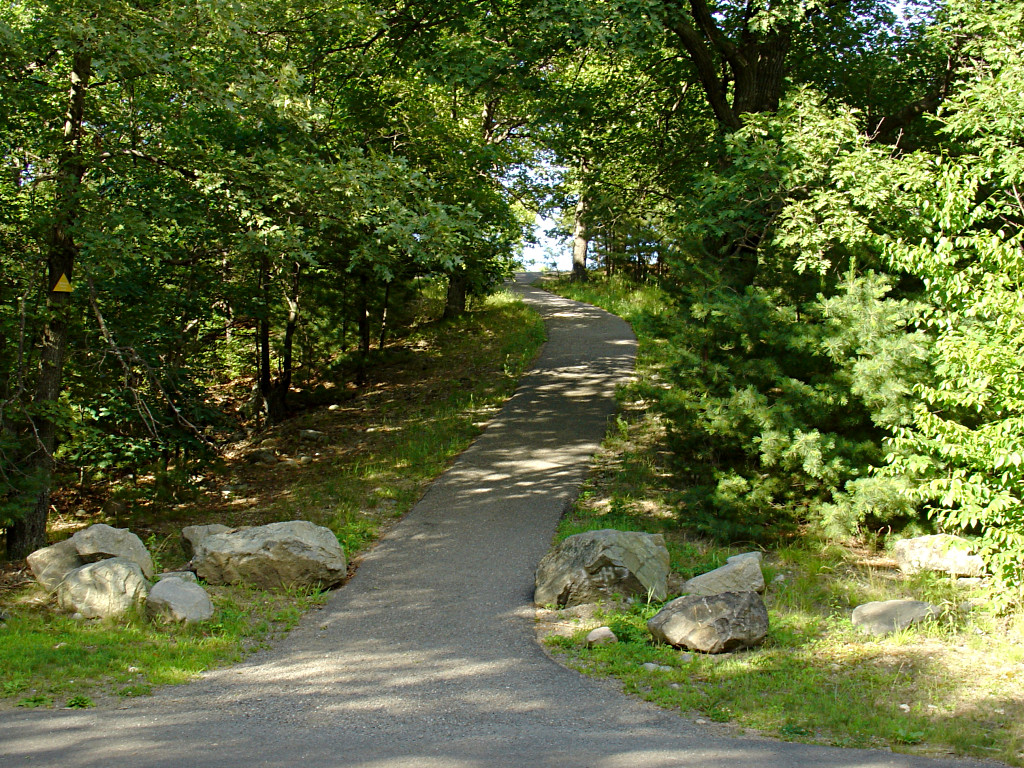 There's no view from the loop, but it's pretty clear what this path heading
off from in front of my car to the right and upward is for...
There's no view from the loop, but it's pretty clear what this path heading
off from in front of my car to the right and upward is for...
 Location 11: Finally!
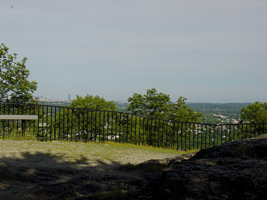
And whaddayaknow, you really can see Boston from here! The dropoff has a
steel fence presumably guarding against accidents, and there's room for lots
of people to stand around up here and gawk at the view.
 Location 12: Arlington
Looking slightly more to the northeast, I can spot the Arlington Heights water tower through a gap in the trees. That is pretty much the top of the hill where Rt. 2 crests and crosses Park Ave before the big warp-stealth scream down into Alewife. So that explains the lay of the land -- Prospect is far enough to the south that the other large hill doesn't get in the way of line-of-sight to Boston, and it's high enough here that smaller features in Belmont and Cambridge don't interfere.
And the descent back to the exit gives all your battery charge back.