Breakneck Ridge in the wind and rain

  This was another short but really fun hike, in a site which had been earmarked on my target list for some time.  Why this particular place?  Several reasons.  It first became known to me as a totally random side-effect of cruising Youtubes about mostly unrelated topics.

I was poking through search results on healthy lifestyle or workouts or something like that, and noted something with "mountains" in the title ... which turned up a longish vlog from someone named Andreea [not a typo] about her whole day of food and adventure.  It notably includes footage from her hike in a rather awesome-looking place called Breakneck Ridge, high above the Hudson River north of NYC.  [Skip to about 04:00 past all the stuff about shopping and breakfast for the main hike part.]  She lives in Marina del Rey now, but at the time of the video it wasn't a long drive from where she and her BF lived in southwestern CT.  Once I figured out which park they were in, I realized it was right near one of my usual travel routes along I-84, and thought "gotta go do that!"  It's part of the Hudson Highlands NY state park system, and here's the official map.

In researching the park a little more, I also found a third-party page warning that the park was about to be *closed* for over a year while some construction went on with the nearby roads.  Eeep!  With the initial target closing date at the beginning of 2018, I figured that my only near-term chance to go see it was on my December run out of state *IF* the weather was still amenable.  This somewhat tentative proposition worked out better than expected, as a fairly overall warm Fall dawdled late over the Northeast and the forecast for the day I planned this was to be unseasonably warm, if a bit wet.  I could deal with that for a quick visit on my way by, and laid out the first legs of my journey accordingly.  I would overnight somewhere fairly near the park, bag it in the morning, and be on my way before the predicted weather worsened.

Everything was pretty normal as I tooled along I-84 out of Waterbury, bucking the usual onslaught of aggressive idiots that routinely plague that corridor.  [Really, as I've noted before, it is one of the worst sections of interstate I know of -- narrow, winding, ill-maintained, with lanes that arbitrarily appear and disappear on short notice, and of course infested with plenty of drivers who think they're more important than everybody else as they zip between New York and Boston.]  But then, perhaps because of the warming trend that day, as I approached within ten miles or so of the Hudson the landscape became blanketed by fairly significant fog.  Oh crap, I thought as I pulled into someplace to overnight in Fishkill, if this doesn't lift by morning I won't get much of a view.

Things seemed a bit clearer the next morning, however, so I saddled up and continued according to plan.  It was still misting a little, but around 50F which is ideally comfortable when one is actively hiking.


[Thumbnail images are linked to larger copies.]
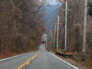
9D descending to the riverside NY 9D runs southward out of Beacon, and eventually comes down a long slope to river level.  I was glad to see that even with the leaden skies and occasional drizzle, the fog was mostly gone even down here.

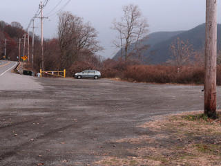
The only car in the lot that morning Mine was the only car in the main parking lot at that time of morning.  Not really surprising, given the weather..

Main trailhead area A short walk along the road, behind a long guard-rail probably installed for the purpose of protecting hikers, leads to the trailhead area.  It starts on the river side of the road, and goes up *over* the tunnel on the big outcrop of rock that drops right down into the river.

Big warning sign about Breakneck The trailhead is festooned with various signs -- *two* like this, and some others advertising map services or the like.  The warnings are all over the park website too.

This pic is actually an assembled composite of screenshots from Andreea's video, since I didn't take one of it myself.  It was certainly not green and sunny by the time I got here.


Trail map, with highlighted route My intent was to do exactly the popular route described on the sign -- a nice short loop, which would nonetheless cover the most interesting and challenging parts of the terrain.  I was counting on a relatively brief experience of the area, with time left in the day to get back on the road and make more progress on my travels.

  And I was about to do everything wrong in the process, according to all the literature.

  • Conditions were wet, under an occasional light drizzle

  • It was *very* windy, mostly from the south

  • I was going it solo

  • And I was barefoot!
But I had finally gotten here, and with the uncharacteristic warmth in early December and how it was mostly not raining, I wasn't going to miss this opportunity to see the place before it might have closed for another year-plus.

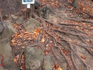
Well-worn ground with roots When the ground is worn down like this leaving all the roots exposed, especially when we expect it all to be under fallen leaf cover, it's pretty obvious that this is a well-used trail.

Facing a steep climb A few feet later the trail turned uphill, and I was looking up at this.  I hadn't even gotten over the road tunnel yet.  It was work-time!  The first stretch upward was a pretty good butt-blaster with occasional holdups to scramble up over the bigger bits.

Freight train closer in Freight train, most of length
Active railroad tracks run right along the river on both sides.  The east side where I was mostly carries commuter rail, and several trains had already zipped by since I'd arrived.  The west side seems to favor freight.  I started hearing a freight train rumbling along the other side, and paused to let it supply a sense of scale in a shot of the mounds across the way.  Then, even at maximum zoom-out, I couldn't quite capture its entire length -- I couldn't even really *see* the tail end, more of it just kept coming.  Still, it's not everywhere that you can see this much of a long freight at once, so it was a fun viewpoint.

At the flagpole Even with the bit of dawdling on train pix, in about 20 minutes I was up at the first real overlook, where there's a ratty old iron flagpole stuck into the rock.  The wind was whipping the flags straight out, and I thought it might blow the camera off its little mini-pod while I ran back down to stand for the timed selfie.  I did wait until the southbound barge was in full view, as it adds sort of a nice touch of depth to the mid-river.  The view was still on the foggy side but at least not totally obscured.

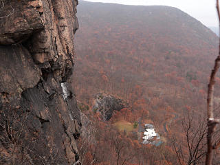
Cliff overlook, above the Chalet The trail runs along the southern edge for a stretch, and a short while later I was on an outcrop near the next big cliff and looking almost straight down on the roof of the Chalet on the Hudson building.  But wouldn't up *here* be a more fun place for a wedding??  In better weather, of course.  On this side of the ridge I was still being blasted by the wind with its little squirts of rain.


Easier path? Bah... Nice rolling glades
The trail finally leveled off a bit and headed toward the ridge centerline, diving into more wooded areas in the process.  This finally cut down the wind some.  I came to a junction with a small sign saying "easier ascent" toward the left ... bah!  I plunged onward, straight ahead, and through some lovely rolling glades.

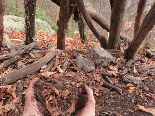
Completely muddy soles Since the ground was just a little wet, the dirt formed a thin and uniform layer of sticky mud on my feet which, interestingly, seemed to give me sort of an additional protective layer.  I could still feel everything I was on, but that the pointier bits were being moderated slightly by what was already stuck to me.  100% natural minimalist shoes??  A mud facial for my feet?

Junction to red trail After a bit more up and down on top of the ridge I got to the junction of the red trail, so this was about the halfway point.  The big climb was over; the red-to-yellow route down would be a gentler slope.

Bannermans castle in the distance Castle detail
Once over to the northern side of the ridge, I got some better views of the island with Bannerman's Castle.  It's a ruin with some interesting history, which one can google up pretty easily.  The pic on the right here is an excerpt from the original 20Mp shot, cleaned up a little, so that's as big as it gets.  With that much resolution and fully configurable in-camera treatment during capture, the Canon G7x-II doesn't need a particularly tall optical zoom to provide quality in small crops.  These new point-n-shoots with the 1" sensor format can really put some SLRs to shame, and I don't even bother shooting raw.

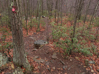
How to nail blaze markers on, and how not to The trails are well-blazed, with color-coded plastic tags.  Here's a good example of the right way and the wrong way to nail them onto a tree.  Leaving the nails out an inch or so [green arrows] allows for more years of tree growth before the marker gets engulfed.  But whoever smashed the thing right onto the trunk and bent the nails up would have to return sooner and put a new marker on, after the tree ate the old one.  In practical terms it probably matters less here since such a popular set of trails will receive frequent maintenance anyway.

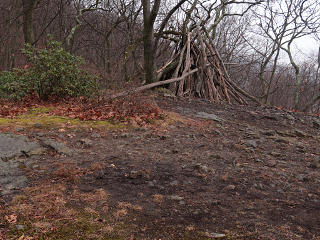
Lean-to structure Lean-to, or ready-to-light bonfire??  This was one of a few such structures I found along the red trail.

Inside the lean-to I sat for a moment inside it, and once again contemplated my hardworking feet.  They still felt great, but I was hoping to find an opportunity to wash them off a bit before getting back in the car.

Fairyland of mountain laurel Downhill from the lean-to, the trail wound through a lovely fairyland of mountain laurel, still proudly green at this time of year.

Down the yellow trail I finally connected to the Yellow trail, which leads back downhill at a more traditional grade.  With all the leaves down I could still see up to the main ridge.

End of yellow trail And here's the end, back down to river level!  Directly across the highway I could see a little yellow structure, which turns out to be a small train platform.  There's actually a "Breakneck" stop here, apparently only active on nice weekends and/or on demand, to serve people who want to come hike.

Distance back to parking lot The Yellow trail dumps out this far north from the main parking lot, and well-worn paths along the highway connect everything together.  By the time I got back to my car, another two or three had shown up.

Loop GPS track from the west Here's a google-earth projection of my captured GPS route.  The GPS said 3.2 miles; the route is said to be 3.7 which probably includes the additional distance from the elevation changes.  I was done in under two hours, despite what it had said about this route on the signs.

The little curlicue at the lower left represents my solution for the muddy feet.


At the bank of the Hudson On the other side of the tracks near the platform, 30 feet farther on is the riverbank, with some nice rocks to sit on.  The water was pretty murky, but here I could get all the mud off.  Kind of ironic that someone had lost a shoe down here, but who could know if it had come from a hiker or drifted from up-river someplace.

Water chestnut pods As I stepped down into that area things felt a little prickly, and it took a second to realize that I was standing on a thick bed of these water-chestnut pods that had washed up.  Nasty-looking little buggers, but while I definitely noticed the pointy bits they weren't really bothering me that much.  I saved this one as a trip memento, to add to my accumulation of "I stepped on this and it didn't hurt" objects.

GPS track from the south Here's an attempt to project the track from the south, and show that initial upward slope along the ridgeline.
<rant>   Generating these into google-earth involves transferring the GPX track off the tablet that was in my pack capturing all this, turning it into a compressed .GDB file for longterm storage and a .KML for google, and loading the latter into the Earth app on the Mac.  The size difference between the GDB and KML formats is well over an order of magnitude, for the exact same set of track-points.  A truly sad testimony on how all these nouveau web-kids have gotten hypnotized by the XML siren-song that makes them believe that bloat is okay and you can always just try to gzip it, when at the heart of the matter they've totally forgotten what truly compact data storage means.  </rant>

Back to the roadtrip Having finally satisfied my curiosity about this place, it was now time to get back to the roadtrip -- I-84 west and beyond, and basically sit on my ass in a car seat for the next 20-plus hours.  But I felt great after this diversion -- well worked-out despite the brevity, and a decidedly worthwhile stop despite the somewhat foul weather.  Good for the sole, as we say!  I'll be back to this place someday, likely on a more amenable day.

_H*   171214

Read more barefoot advocacy