Dayhiking Welch-Dickey and Franconia Ridge

  Day two: the big challenge

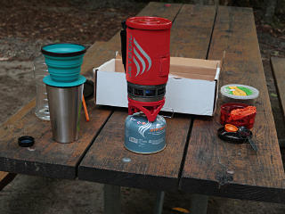
Morning coffee setup A lovely and downright chilly morning dawned, bringing certain immediate priorities with it.  My "coffee in the middle of nowhere" kit had gotten a bit of an upgrade recently, swapping out the clumsy old Melita brass filter in favor of a collapsible silicone X-Brew dripper I'd picked up at REI.  This made it so that the entire kit including coffee and sugar containers could fit in the box, which it hadn't before.  The filter mesh is very fine, but I found that it needed a fairly brisk pour to keep enough liquid above it for a good extraction.  The output was entirely adequate for bootstrapping my day.

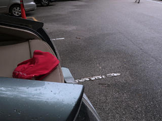
AMC car, and one of many Teslas I packed up and moved out of the campsite, and around to the general day parking near the campground entrance.  I was basically right across the Pemi River from where I'd slept.  I was still on the southbound side of the highway but there's a convenient tunnel to the trailhead on the other side, so it wouldn't really matter which side I parked on -- and southbound, I'd be conveniently positioned for the return home.  All the general parking around here is free, because it's managed by the NH state parks system and that's how they handle things.  The US Forest Service trailhead lots around the rest of the Whites are where the $5 day-use fees are often charged.

I was amused to spot an AMC staff car, possibly used to bring in supplies for the huts to where "croo" members would then walk them up on packboards.  I included the Tesla in the rearview as a reminder that I had seen *many* Model 3s in the area, reflecting what I'd also seen around home -- after all the ballyhoo about such deep waiting lists for those cars, there seemed to be an awful lot of them on northeastern roads by summer 2019.


Pre-hike stretching In addition to applying sunscreen and bug repellent, it's always prudent to stretch out and warm up a bit before starting a hike.  I know which parts would start giving me grief if I don't do this, especially the IT bands and other stuff around the knees on the downhills, so I go through what I refer to as some "bogus yoga" moves to deal with those before putting real load on them.  I still haven't felt any real need for hiking poles, but maybe someday...

Tunnel under 93 The tunnel under 93 would warp me into a whole different world, where it would just be me against the mountain, where "gravity sucks" governs the day.  I would spend a good chunk of my morning converting trail-mix into elevation gain, and on this I wasn't going to try and rush it.  Where I'd parked on the southbound side would add another half-mile-ish to my trip total anyway.

Lafayette trailhead parking, fairly empty It was about 8am as I strolled through the main Lafayette trailhead lot, and finally here was one answer about midweek mornings: not all that crowded after all, even on a day that promised excellent weather.  It would probably get busier later, but it was certainly well past dawn here and both of the Lafayette lots still had plenty of open slots.

Following other hikers I started out behind a small group of other hikers, but at the split between Old Bridle and Falling Water I headed off to the left, while they took the more traditional direction for a counterclockwise loop.  Again, I chose to go clockwise, and for today, increasing my chances of meeting more people coming the other way -- that not-so-secret agenda of being the living example of what we're capable of, and engaging in banter about footwear if someone asked about it.

Normally I'd consider this pic a total fail, as shooting on the fly with the ISO set too low isn't likely to end well, but in this case it made sort of an interesting "action shot".


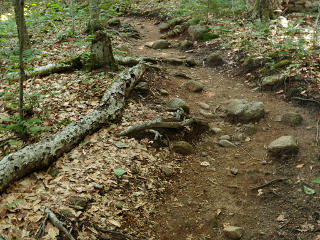
Generic dirt and rocks The trail was just generic dirt with a few rocks for quite a way, in fact rather foot-friendly so far.  I figured that wouldn't last long.

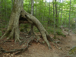
Flying-buttress root More strange root/trunk structures; I wonder if this grew around a rock that had since moved somehow?

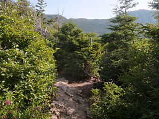
Rocky trail upward As the trail started to ascend the west ridge for real, it became more like what we expect in New England's mountains: lots of rocks and roots.  Here's where relatively unencumbered agility really shines; I always love hopping along over this sort of stuff.

I began to meet some small groups coming down, who had evidently overnighted in the hut and were just starting their days too.  One person told me they'd seen another barefoot guy along the ridge the previous day.  I confirmed for them "yeah, it's a thing" even if still relatively rare, but it left me wondering -- where are all these other barefooters, I want to meet them!  A couple of the AMC trip leaders I've talked to have also mentioned seeing other people enjoying the "feel of the White Mountains" on occasion.


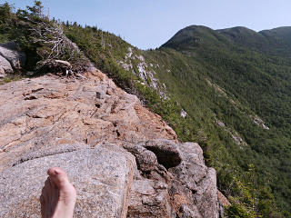
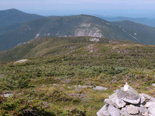
Breaking out to ridge cliffs Bare cliffs along Lafayette ridge
After a while the trees started getting a little scrubbier, and I eventually broke out onto some bare rock slabs along the ridgeline and a better view of what lay ahead.

Vein of white quartz From sweeping vistas down to small detail: a mini-mountainscape of white quartz vein embedded in the granite.  There is *so* much to see in nature like this ... it's not just about the views, there are whole worlds right under our noses.

Different type of rock leading up And under our feet, too.  The trail continued up over some seams of very different rock for a while -- harder and smoother and a different color, interestingly packed, and also felt very different and actually a bit less grippy than the usual grey stuff.

Another view to the south As the ridge curved around, I was able to see to the south.  Note the similarity to my Dickey ascent -- a curved ridge, another view of 93 stretching away down the valley, and the the cliffs in the middle distance were where I had first popped out of the woods to bare rock.  Except that the scale of all this really was about twice as big.

Roof of Greenleaf hut ahead The trail leveled out, and soon I got a first glimpse of the Greenleaf hut roof ahead.  I stopped in to top up my water and grab a couple of bites of food.  The hut was pretty empty; whoever had stayed overnight was long since breakfasted and gone, and two or three croo were there cleaning up.  A few other hikers were resting outside, headed the same way I was; I'd passed a small group shortly before the hut but today, I was really trying to think about pacing rather than my usual mode of blasting by other people on the trail.  I had made the hut in about 1:45, though, and perhaps even that was pushing too hard?  I still had a steep mile-plus ahead of me before the worst part would be over.  On the other hand, the twenty-somethings on the hut croo told me that when they bring the supply packboards up or down, loaded with anywhere from 40 to 80 pounds, it takes them about two hours, and they do that roughly every week.

Hut technical details I inquired about some of the infrastructure details, as the huts have on-site running potable water, power, and waste disposal.  The solar panels on the roof are obvious; not so much for where it goes when they flush.  One of the staff dug out a looseleaf full of details about this, so clearly the AMC is proud of how it's put its sites together and how the technology has evolved over time.  I was most interested in that disposal aspect, and photographed the relevant page for later.  [The big-picture is entirely readable]
It's rather amusing how we [and some other mammals] socially treat our intake versus our elimination.  We come together to eat, and we separate to take care of the inevitable business afterward [and, as seen right here, attempt to euphemise the crap out of it, so to speak].  A common hiker phrase, in fact, is "separation break" -- the opposite of having a snack and water when a group stops for a rest.  We often *want* to be together when we take in nourishment, often gathering for the purpose and wishing to be actively seen and entertained by each other in the process ... but quite the opposite as far as disposing of our waste products.  And yet both functions are equally present and important in our lives.  Does the distinction really make logical sense?  Our consumption is conspicuous and communal; what occurs at the other end is obscured.  But the light at the end of the tunnel is so obviously an integral part of the process, that some deep part of us must mock the artificial-ness of our secrecy around it.

This is why, no matter how "mature" and "sophisticated" we think we are, at some fundamental level well-delivered bathroom humor is always funny.


Looking back to hut and Cannon rockslide I found where the Greenleaf trail continues up from the hut and started down it -- literally down for a stretch as it dips and goes by the nearby lake, today through a big glorious mudpuddle.  Then came the last big upward push to Lafayette, and it didn't take long to rise again to well above the level of the hut and see Cannon dwarfing it from behind.

It's not too hard to squint a little here and envision the Beacons of Minas Tirith flaring on the peaks as epic music plays in the background ...


Rough native scree along trailside Much of the trail had been "hardened", or reworked as far as its surface, to make its track obvious and perhaps a little easier to navigate.  Off to the sides for much of the upper part lay this rough scree, which would have made for much more tricky going than the stair-master of big rocks I was now on.  That was taking it out of me nonetheless; it was a rather fatiguing and relentless climb, as it was gaining another 1000 feet in a mile or less.  I got a brief and welcome rest by chatting with a guy who was sitting trailside and taking detailed photos of the plant life, and then kept grinding up as the summit slowly drew within reach.

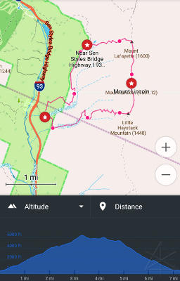
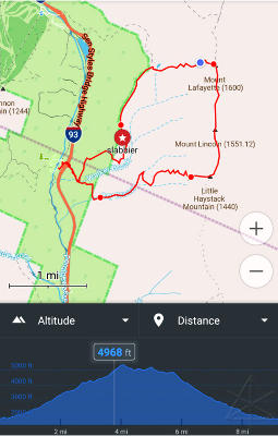
GPS pre-plot with artificial elevation profile GPS actual track with elevation  
Predicted Actual  
While reliance on "devices" alone is discouraged in the hiking literature, having Open Streetmap running on the phone serves several purposes at once.  [It's also pretty hard to get lost on this loop if you've done *any* advance studying.]  Many recreational trails are accurately documented in its database and keep being added to and refined, so it's not only a decent map, it's an interactive display of one's progress and a fairly reliable way to capture an entire hike's track for later analysis.  In my own process of using it I had added or fixed a few familiar trails in the global database too, using recorded tracks and on-the-ground local knowledge.

And I had just discovered one more interesting aspect during my trip prep: even though the map displays in the Android app have no information about topography or height, some concept of elevation data must be embedded because it implicitly appears in the process of route planning.  When I laid out a navigation route starting near the bottom of Old Bridle Path and ending near the same point with waypoints over the peaks, the app constructed a route quite accurately along the trails and when I displayed the route details, there was an elevation profile -- seemingly from nowhere!  Thus, after doing the hike I could compare the "predicted" data versus the actual elevation figures captured during the day, and they're quite close.

The difference is that a completed track has real-life points in it, allowing detailed display of data anywhere along it by sliding a cursor along the track timeline.  Still, being able to mess with a fabricated *theoretical* hiking route and get an idea of its height profile is useful.  The OsmAnd community offers a "hillshade" plug-in as a for-pay additional app feature, and I suspect that it simply allows representative interpolated display of contour information that already comes in the database downloads.  Perhaps having it would make my map look more like this.  Meh -- don't really need it after all, I can do that sort of stuff online.


  Owww ?!

So note where my marker is in the "actual" trace above, corresponding to the blue dot just west of Mt. Lafayette.  There I was, toiling upward near 5000 feet with the summit in easy sight, and then came the major setback of the trip.  I noticed that my right Achilles tendon was hurting a little.  I took a brief rest, gave it a quick stretch, and kept slogging.  Then it started hurting more, and the area of interest seemed to move up my leg toward the calf.  In about ten minutes I realized that I was having a partial recurrence of the pulled calf muscle I suffered back in December, and after a couple of particularly painful steps I knew that I needed to stop putting high load on that leg and foot RIGHT NOW, and baby it as much as I could.  My body naturally adopted a sort of limping gait that basically used the right leg as a stump, not using the ankle for any meaningful "launch", like I'd had to do for a couple of weeks in January.  [The original injury was noted in that year's Arisia writeup: stated formally, a tear in the medial head of the gastrocnemius near the musculotendinous junction, an absolutely textbook injury often brought on by various athletic activities including hiking.]

Well, this suddenly sucked, and raised a serious quandary: Now what?  Having my walking ability compromised could mean some bit of trouble.  I was at my maximum elevation and nearing the halfway point of the hike, so going either back or forward meant a long gnarly way down.  I had no idea why the damn thing suddenly went out on me like that, but it clearly wasn't going to magically fix itself in the next ten minutes.  The other immediate ass-kicker was the mystery factor!  There hadn't been any *hint* of a problem up Welch-Dickey, or any trip before that -- in fact, I had been hiking fairly vigorously over much of the spring/summer, so it wasn't like I got off the couch and tackled a strenuous 9-miler unprepared.  Nothing weird had happened that morning that I could identify -- I didn't stumble or come down funny on that foot as far as I could remember.  I was a little fatigued overall but knew the major climb would be over soon, I was drinking plenty of water and taking short rest stops once in a while, I was really trying to pace myself -- not trying to beat any records or the other hikers around me.


On top of Lafayette, trail off toward Lincoln As I summited and hobbled around a little, however, I realized that it was walking on level ground that hurt the most, and that stepping up or down with the right foot wasn't as bad because in both those cases, the foot would be out in front of me with relatively little dorsiflexion.  It was load coupled with the foot flexed upward that was really twinging it, which is exactly what happens for an instant during a normal flat stride as the rear foot pushes off.  Even in a shoe.
I pondered all this more deeply while sitting down for a bit of lunch, a mile above sea level.  My feet were doing absolutely fine and loving all of this, it was *other* parts that were giving me grief.  But it wasn't a total showstopper, not like a sprain or break -- and part of why I came up here was to walk that amazing ridgeline, so dammit, that would far and away be my choice over trying to retreat back down Greenleaf.  With plenty of daylight still ahead of me and feeling relatively confident that I could be super-careful and not twinge the ailing leg, I started picking my way along the ridge. 

Alpine plant life I stopped to take my own sampling of the alpine plants -- the guy with the camera had rattled off a bunch of names for things, but I couldn't remember what was what.  He had mentioned that the grass-like plants are actually a type of rush, not a grass.

Trail up toward Lincoln Some gravelly terrain, not all
As I'd already discovered, the flatter sections were more of a problem on the calf than the ups and downs.  There was relatively little of the gravelly stuff, and what I found was quite benign to walk on.  The rock still felt great, and I got a gratifying number of reactions from people as I went along -- mad props and kudos of all sorts, "holy crap, barefoot?"s, and even a couple of fist bumps.  I briefly chatted with a fellow who, while shod himself, knows some of the other Boston-area barefooters and was pleased to see me out here taking on the big stuff.  Whether the mystery barefooter up here yesterday had encouraged others to research the phenomenon or not, I certainly doled out my share of online search suggestions.

And as every page about Franconia Ridge will tell you, the views to either side were just awesome.  Weather-wise, I had picked a nigh-perfect day.  As Mt. Lincoln lay ahead, I could see quite a few people on top of it; this gave a nice visual scale of what humans about a mile away look like.


View down to Lafayette campground As I wandered along I came past the line of the western ridge on the way to the Lincoln summit, and could now see down to that same campground off-ramp where I'd taken the shot upward the previous evening.  I had just walked up here from waaaaay down there, and was eventually headed back down to it.

A rocky spire People have probably climbed up that spire, although I couldn't find any specific references.  Today was probably not my day to go play with it.  Somehow, it seemed tempting to get down in between there and try pushing really hard ...

At Little Haystack ... which is *not* what I was doing to the signpost on top of Little Haystack, it was already leaning before I rested my foot on it and a helpful fellow took this shot for me.  At this point I had made it along the two-ish miles of ridgeline, and despite the ailing leg, had a blast with it.  Now it was time to turn downhill again, and hope I could get me and my malfunctioning muscle off the mountain without further incident.

Dusty rocks going down trail As long as I stepped down onto surfaces slanted away from me, the right leg was okay.  Any up-slope, such as a root angled the wrong way or the rocks making up water-bars, would bring some pain right at the indicated spot.  I quickly learned what to aim for and what part of my foot to land with, and found that I could still engage my toes for better "braking" grip as long as I stayed off the calf.  A minor slipping hazard stemmed from the fact that a lot of the rocks had a dust coating just from the amount of foot traffic over them, but my mechanoreceptors could still evaluate that pretty quickly in the process of each step and keep me out of trouble.  In addition, there are a lot of smallish trees lining the Falling Waters trail closely on both sides, providing handy arm-level grab points, which I was instinctively reaching for to stabilize.

Our musculoskeletal systems and the meshed sensing networks that drive them really are fascinating, not to mention highly adaptible.  My body was automatically doing everything it could to get me out of this situation and minimize collateral damage.


Red squirrel There were quite a few red squirrels, and they seemed relatively unafraid of humans.  I suspect that they get fed their share of trail-mix...  This one skittered only a short way up a tree as I came closer, and then sat there vigorously squeaking at me as they often do.  "My territory!  Go hike your own hike!"  We had a brief but amusing conversation here, done almost entirely by body language despite any of the noises either of us were making.  "Squeak!"  "Woof!"  "Squeak!"  "Squirrel!"  ...
With all the abrupt and high-stress motion that squirrels go through all day, I wonder if they ever get pulled muscles??  I looked at this little fella's tiny feet and general form, in basic structure very much like ours or a dog's or whatever with the same kinds of bones, tendons, muscles, fascia, and all the nutrient and control mechanisms around it.  But try asking any squirrel leaping between branches sixty feet in the air about its appreciation for integrated systems, that grow from the exact same chemical building blocks into the highly specialized types of parts that we both share and don't share.  Maybe I could be proud of how I dance my way down a trail with high navigational confidence [under normal circumstances, not so much today], but who knows what any of *us* would be able to do with a much higher strength-to-weight ratio and a set of claws that could stick to wood like this?  What would squirrels say if they grew big ugly brains and wrote web-pages?

Maybe we wouldn't be so hung up about pooping in public.


Tree fallen across one waterfall After what seemed like a long time of diligently working myself down the steeper parts of the trail, I finally reached where there was some actual Falling Water.  And some fallen trees, apparently; this one had neatly bridged the gully and was very bouncy, and if the leg had been better I would have been tempted to hop up on it and ride 'em cowboy.

Sitting above a cascade The trail really does basically follow down Dry Brook, which is anything but, and crosses it several times.  There were numerous opportunities to stop and play in cascades and pools, not to mention refresh the moisture in the damp sweat-rag attached to my pack strap.  [That's a trick I had adopted recently, an enhancement to the hiker bandanna but using a terry washcloth that actually absorbs moisture, and keeping it damp for better evaporative cooling.]

Meta-picture of people at falls At the big Cloudland cascade, one of the main features along this trail, a lot of picture-taking was going on.  I had been sort of "leapfrogging" with the couple and the dog being the photographic subjects here since about the Greenleaf hut; I was a bit faster than them until the leg went out and then they were faster, but our various rest/snack stops seemed to interlace about evenly around the loop.  Their dog was *incredibly* mellow, and entirely comfortable with the hike.  The woman said she does carry dog-booties for really rough stuff if needed, but rarely puts them on [the dog].

Big slab heading down One of the last crossings is just one monster slab hump with the brook running along the bottom of it, and the trail diving off into the woods on the other side.  Woods that had, in fact, gotten quite a bit darker over the course of the last couple of hours as some heavy afternoon clouds had rolled in.

It *just* started raining at return to car I got rather lucky on my timing, in fact, as rain started to come down *just* as I finally gimped my way back to the car.  But it started slowly enough that I still had time to clean up a bit in the same piece of stream that I had accessed from the campsite the day before, change to a dry shirt, and relax for a bit before getting on the road home.  As I headed through Lincoln, the rain became heavier and I felt bad for the people I had seen heading *up* the trail less than an hour ago.
So I made it off the mountain without killing or maiming myself or needing an airlift out, and still enjoyed the overall trip.  9 and change arguably exhilarating miles, total time about 7 hours.  My feet felt like they'd barely noticed the distance -- none of the post-hike tenderness I get once in a while after especially rough terrain.  My knees also felt just fine, even after one of the longest downhills I'd done all year -- from experience, those arched-over "side fascia" stretches really do help with the illiotibial situation despite how some medical literature dismisses the idea.

Maybe all that and "hey, nobody died!" makes for a successful trip and mostly passing the test I'd set for myself -- elements of win, elements of fail.  It still really galled me that I'd now have to stay off the calf for another couple of weeks and heal back up.  That was *not* part of the resources I had any intention of "using up", I always need those locomotors!  But it was already clear that the pull wasn't nearly as bad as it had been back in December, when I hadn't realized what was happening and kept trying to run on it.  It was also likely that going right into Arisia after getting home kept me moving on it more than I should have and didn't allow for rest and the right kind of rehab, so there may have been some remaining scar-tissue in there which never got massaged away properly, left a weak point, and that's the area that let go.  This time, I'd take better care of it in the recovery process and hopefully be back on the trail in short order.

[In the following few weeks, healing seemed to be surprisingly rapid and I was soon able to do a bit of careful experimentation to learn more about what types of stress were more risky.  Once I was feeling more confident on the leg, a trip up a "medium mountain" allowed me to pretty much figure out what had gone wrong, and what the major triggering circumstances had been up Lafayette.  Read my ultra-scientific lab report for the details.]

_H*   190722