RoadtripPart 2: local Wisconsin tourismand slightly beyond |
Part 1:
first leg to Hybridfest
Part 2: local Wisconsin tourism and slightly beyond Part 3: South Dakota, Black Hills Part 4: bangin' around the Northwest Part 5: meandering east toward Denver Part 6: doing tech at Denvention (aka Worldcon) Part 7: the journey home |
|
I decided I'd had enough of the campground's mosquitoes, and moved my base of
operations for the next couple of days to the same Days Inn that Hybridfest had
been in -- it offered a good rate and reasonably stable internet access, so I
could try to catch up on stuff. I did a little trip-planning and actually
dipped into that "local attractions" book that we usually find in hotel rooms
and ignore, and spotted a couple of minor things that might
hold some interest. But the major recommendations came from the Hybridfest
staff folks, both at the Culver's dinner and at the in-house breakfast the
next morning.
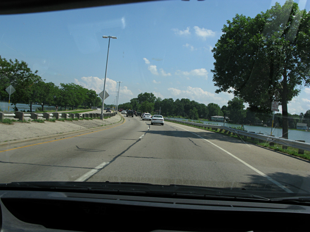
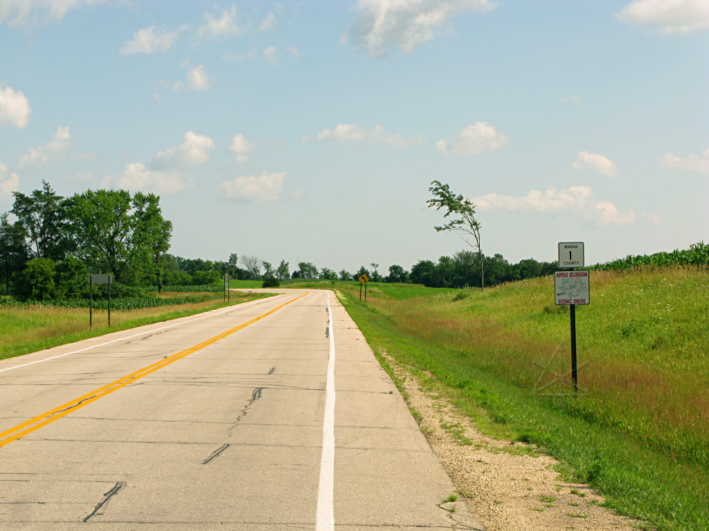
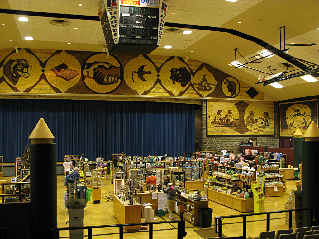
I had been to Hybridfest three times now and had never actually made it into downtown Madison, and set off for a loop around the southern lake which would take me pretty much through the heart of downtown. The heat over the weekend had finally broken, and it was almost chilly that morning -- a welcome relief if I was going to spend some amount of the day in the car. |
|
|
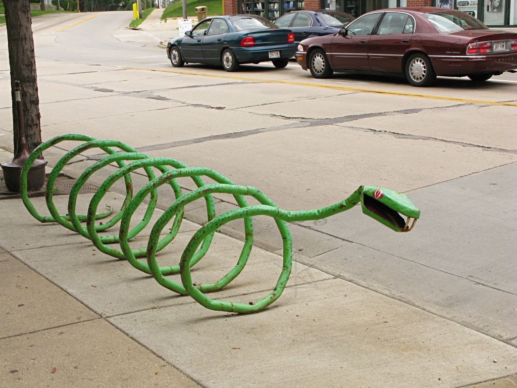
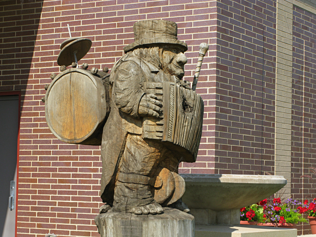
An amusing bike rack spotted as I came into the eastern end of town. |

|
|
|
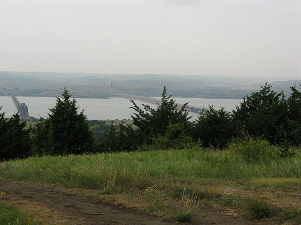
I found a reasonably inexpensive parking deck near the water, and discovered
that it has a nice little public garden / park on the roof -- complete with
fountains and working, unlocked restrooms.
The somewhat hazy day was *very* bright amid all the white concrete, making it a bit of challenge to play focal-plane games while shooting some of this. Fortunately the G9 has a neutral-density filter I could drop in to cut down the light level through a larger aperture and go around trying to be a little more artsy with foreground/background depth of field. | |

|
Only one among hundreds of possible wallpaper shots that one could have taken here! |
|
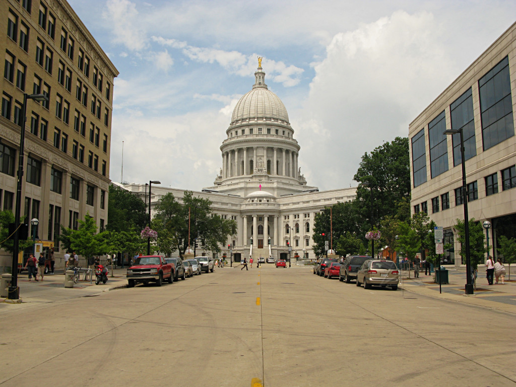
But my main goal was to go explore the capitol, on the recommendation of several of the locals. The street layout around it is apparently based on the US capitol in DC -- at the center of eight directions of roads, but of course Madison is already oriented on a 45-degree angle to the major compass directions which makes keeping a sense of direction a little more challenging. But I basically walked away from the water. |
|
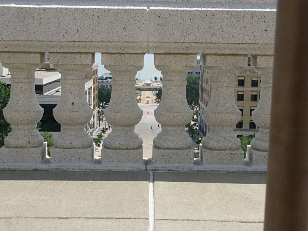
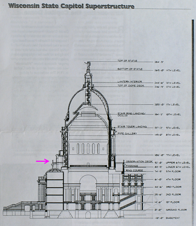
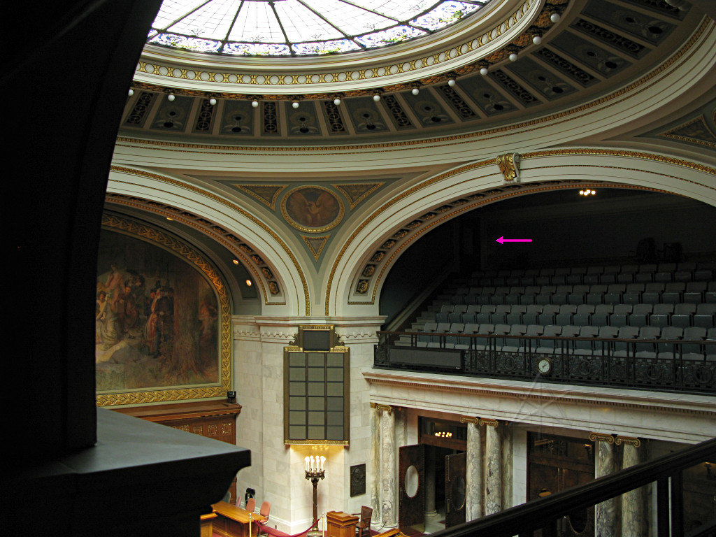
Soon enough I got to the capitol. Note the little pink arrow above the lower
domed roof, which isn't part of the building.
Madison seems to be a pretty progressive town. I ran into a couple of anti-war groups demonstrating a block away, and getting *approving* hails from passing traffic. And there were Priuses everywhere, which in itself seems to be a good indication of how a city thinks. Overall it felt sort of like Boston, but less squeezed-together and with cheaper parking. |
|
The lower doors were just open -- no guards, no metal detectors, no ID check, nothing to indicate any assumption that everyone on the outside is an explosives-laden suicidal terrorist. I just walked on in, and soon found myself under the central dome. |
|
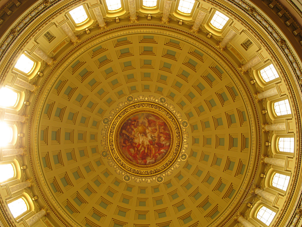
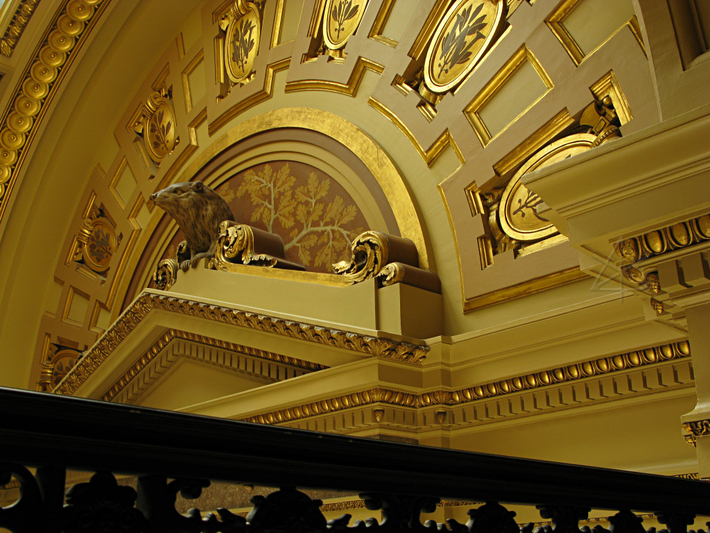
The locals were right -- it *is* a gorgeous building. Lots of fun detail in
the architecture, with interesting green and pink marble accents which
complement the overall gilded theme inside. A sensible layout, although it's
easy to become confused about which of the four identical wings you're facing
without reading the signage carefully.
I began going upward, staircase by staircase. If you take note of the little door high up behind the railing ... |
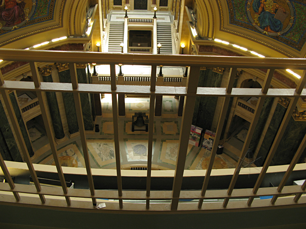
|
... this is what it looks like from there back down onto the main floor. |
|
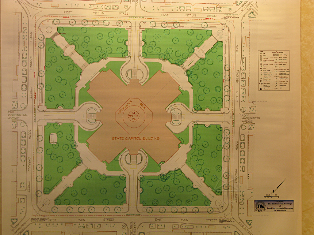
At about this level I found the little iron spiral stairway to the observation deck, went out and around to the southeast side, and here's where the other little pink arrow points. This one points to where I was standing in the middle of the street before. Behind there is the pedestrian walkway back to the parking deck, its garden and fountain, and the lake behind that. |
|
The open observation deck is really not that high up on the building, but from there up it's basically just the dome. I got this diagram from a guy sitting at a desk near the bottom of the iron staircase -- it's actually part of a stock handout they give the public. The first thing I noticed was the continuation of the spiral staircase upward and out over the "oculus", and asked if there was any chance of going up there instead -- but unfortunately off limits, although it would have been twice as high up and over the main dome and completely awesome. But we got to chatting about why I was in town, hybrids, fuel, environment, and that sort of thing and I must have been there for 20 minutes breaking up the boredom of his day and learning more Capitol factoids. Around that same level there's also a sort of mini-museum with artifacts from the building's rather varied history including major fire damage in the 1800s. |
|
There are big lights at the end of each wing to hit the dome at night. |
|
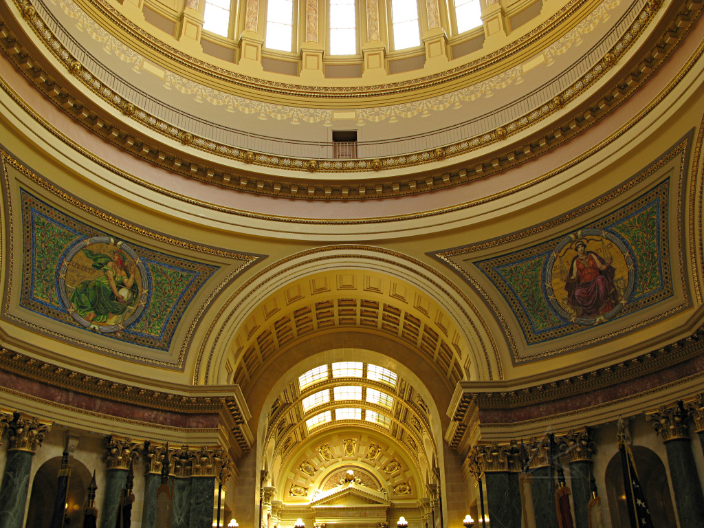
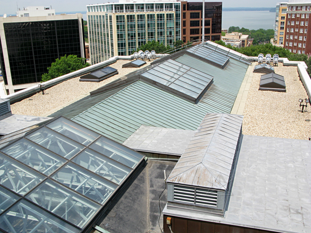
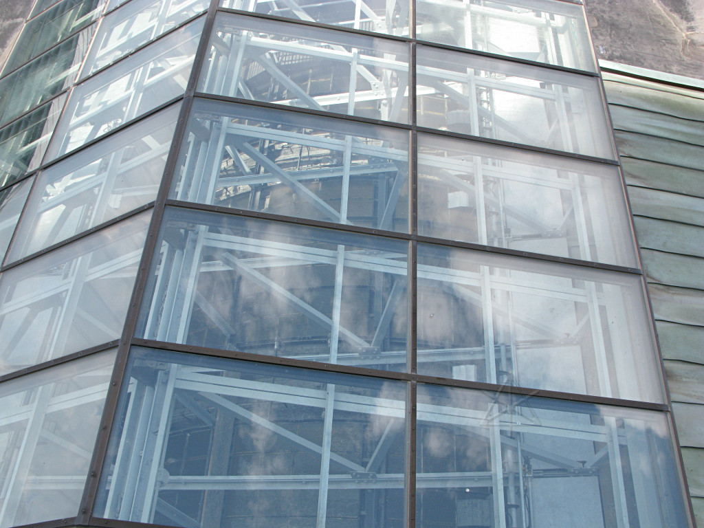
Some of the skylights are over offices, but some are not placed over habitable space. Down through the near one I noticed that all that's in there is the support structure for the barrel vault below. But the ones farther out appear to connect through to the glass in the vault ceiling, bringing more of that ubiquitous golden light into the space. |
|
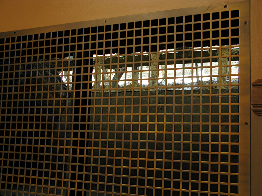
After going back inside I found that the air-intake plenum along the hallway simply opens into that same above-vault space, so it's all part of the air handling system. Here I'm still one level above the vault in the center of one of the wings. |
|
Then, down one more level and I'm under it. Each one of the wings has a
similar ceiling with the same sort of detail and this critter guarding the end
of it. I have no idea what the critter actually is, so I'm going to simply
assume it's a wombat. The official Wisconsin Wombat, or something.
|
|
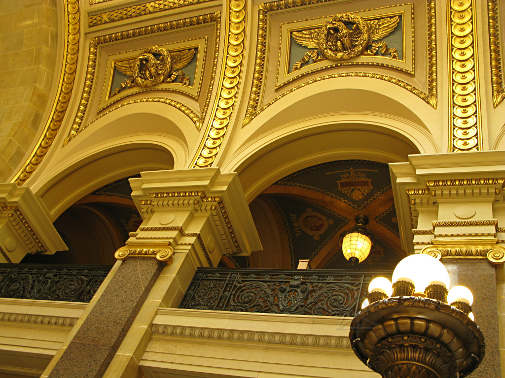
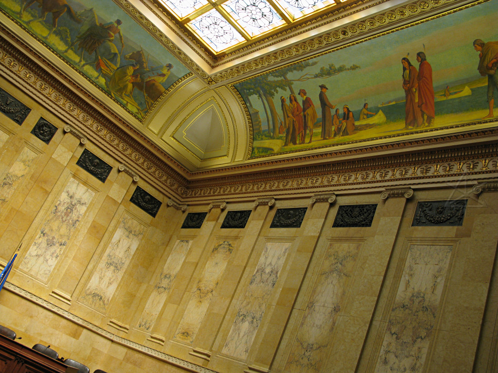
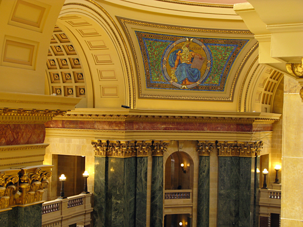
More of the nice central-vault detail, in a style mildly reminiscent of the Newport mansions I visited earlier in the year but a little less baroque. The side hallways lead to offices on multiple floors -- offices of senators and other officials, many doors wide open, and again completely unrestricted to the public. I could walk along and hear phone conversations going on, and hardly anybody even looked up when I passed their doorways. I guess they're used to wandering tourists. |
|
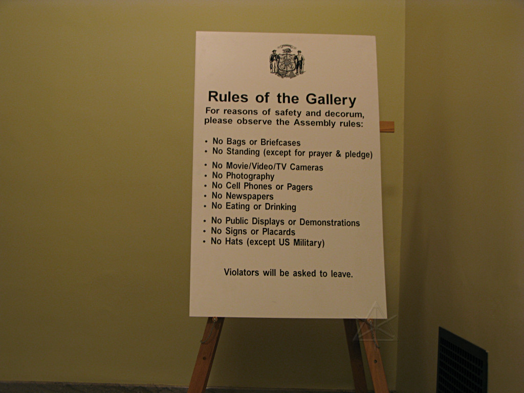
Near the end of one of the wings I was heading up a stairway and ran into the first instance of any posted rules -- and a very oddly restrictive one, at that. No hats or newspapers? Prayer?! Well, as progressive as the place might be, they evidently still have trouble separating church and state. What could this ultra-sacred Gallery be, anyway? |
|
Another half-flight up I found my answer. The door into here was locked but
the glass was *very* clean. This is evidently where highly-placed politicos
sit in their leather comfy-chairs and ... legislate.
Now, did you notice where I had to 'shop out a nasty and unavoidable reflection of a bright yellow glass globe light in the hallway outside, before I just mentioned it? The window was clean, but not AR coated... |
|
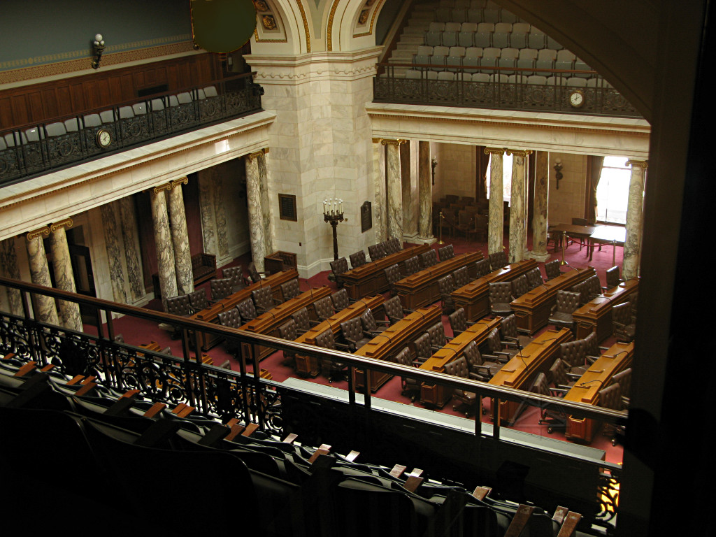
I worked my way around to the other side, finding another locked door but
another view of the room; the arrow is where the other door is into the
observer seating. It's got a big skylight and large murals and nice stonework,
even if cynical lyrics about "hollow laughter in marble halls" were beginning
to tickle my thinking.
No idea what the multi-screen looking thing at the corner is, whether it's video or something else. Later research hints that it may be some sort of electronic vote-tallying system. |
|
Lower down I found another room set up at best guess like a courtroom, that
was open and empty. The crazy angle is to try and show the ceiling murals --
I wedged myself way into one corner to try and capture more of the room,
almost wishing I had
efusco's fisheye
wide-angle.
I found the mirror-image "rorschach" marble panels pretty interesting; they must have been cut very thin and then opened up like a book in pairs, and then pairs of those sets kept together and top/bottom inverted for an almost 4-way symmetry look. |
|
Another view across the central space, with a little black shape that some readers will immediately recognize sitting up on the ledge. Why there? Probably to light the wombat. |
| I finally tore myself away, figuring I'd already gotten far too many pictures of the place, and wandered a circuitous route back toward the lake. For those that may disagree about my data volume, there's plenty more info at the official capitol site that does include some text about what one would find by going up into the dome and lantern gallery. Well, up until 1931, anyway. |
|
Upon getting to the shoreline, I realized that I was seeing way across to Olin-Turville from here -- there's the hill and pavilion. It was then a short stroll back to where I'd parked. |
|
|
| I completed my loop through the city and traversal of the isthmus by driving out along the part of John Nolen I'd never seen, which goes along a narrow causeway. As I came back into familiar territory and looked to the right at the Alliant center, I was amazed to see that all the carnival stuff that had been there the previous day was GONE. That big parking lot was pretty much empty! Those carnies work fast, I must say. | |
|
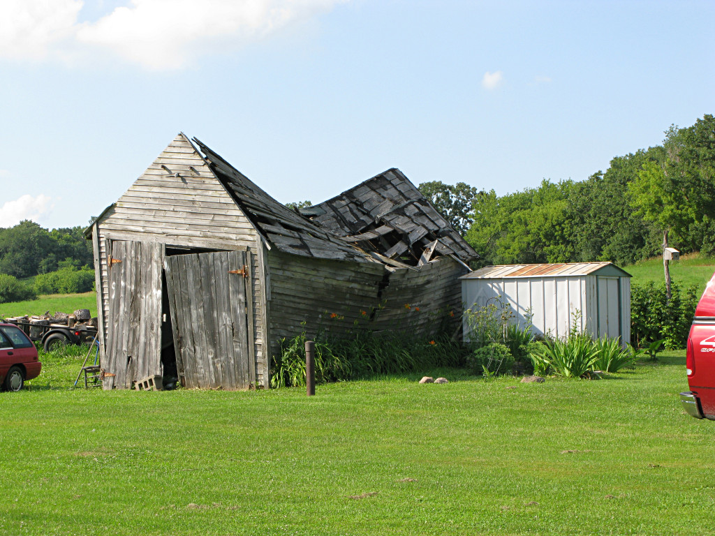
I went out along part of the MPG challenge route, because I had remembered
seeing this while out on my press-coaching run and wanted a picture. [I had
completely failed to spot it on my own MPG run, because I was concentrating
too hard on my driving.]
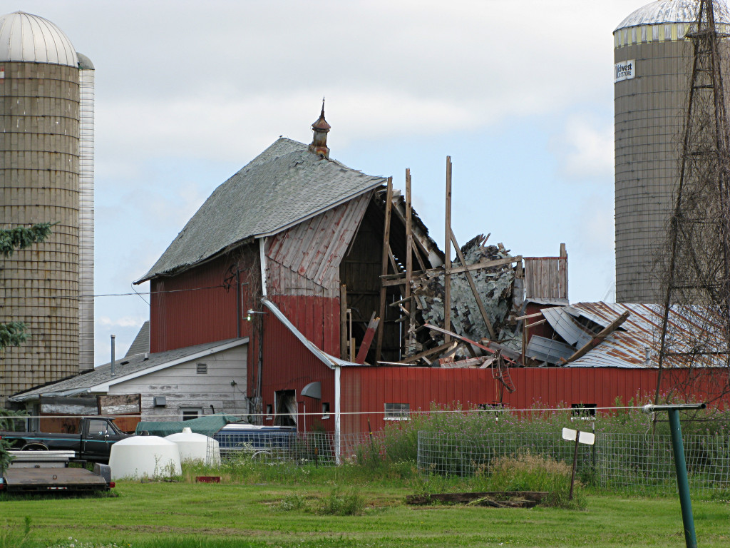
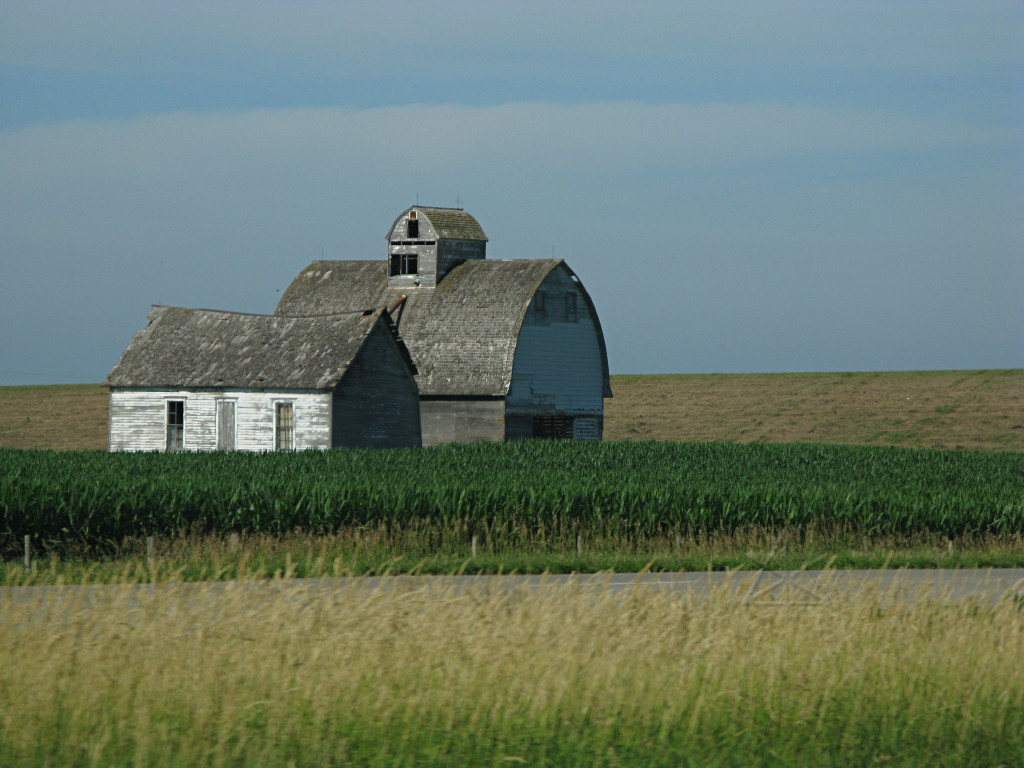
Why a decrepit barn? Because I've decided that it's sort of a theme. I see quite a few of these when tooling around the countryside, and some of them are really interestingly falling apart. Not to make light of someone else's diminished property values since I'm sure the owners didn't necessarily *want* their outbuildings to get into this sort of condition, but there's a certain aesthetic about it that almost warrants turning a series of these into a coffee-table book or something. Same idea as ruined castles in Scotland, perhaps. At any rate, I've been collecting shots of this sort and here was another good specimen for the series only a couple of miles from downtown. |
|
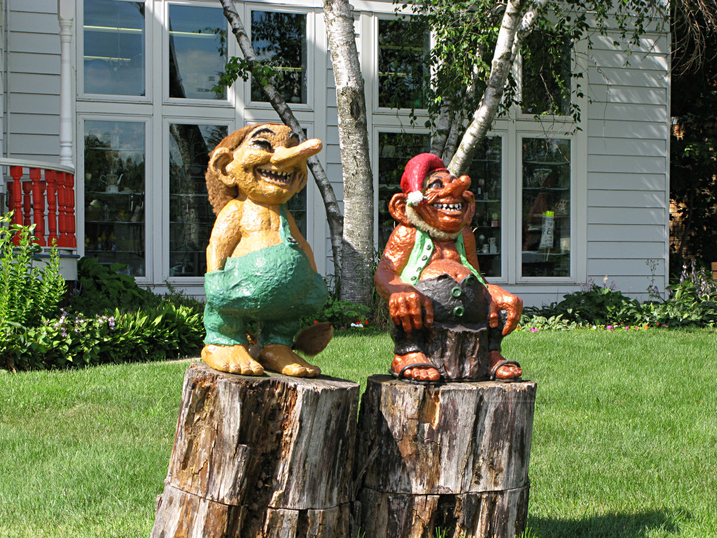
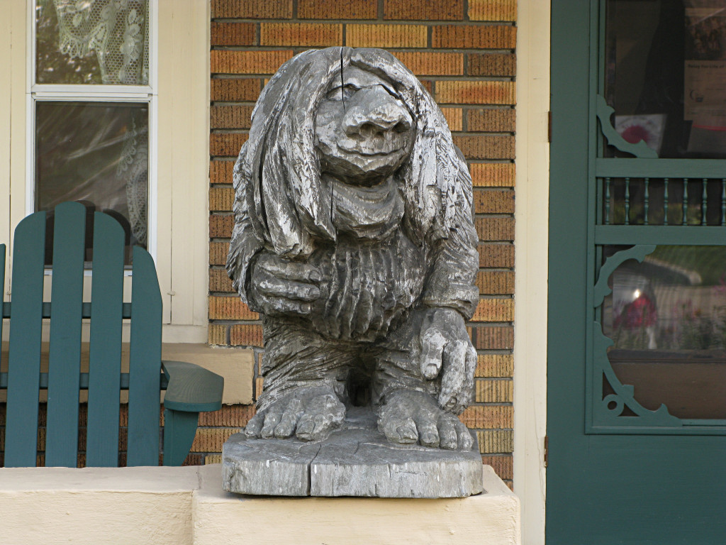
I then continued out toward Mt. Horeb, where the hotel tourist-trap book had
said there are trolls. And there are! The town refers to itself as the
"trollway"
and encourages visitors to find all the carved homunculi.
I navigated a series of newly-installed roundabouts on the main road coming into town, which I thought was very cool to see. Roundabouts, aka rotaries but with better design, are coming back into popularity as a good traffic-handling device because people are finally beginning to realize that with proper use, they're highly efficient. "Proper use" is the kicker, however, since many drivers have forgotten what they might have learned about them back in driver's ed and a bit more public education may be needed as they become more widespread. |
|
|
| There actually aren't all that many trolls, at least along the main drag, and they tend to be back from the road a little. These are in front of a dentist's office and a bank, respectively. They were all evidently carved by one person who in part just loves doing it as part of the town's Norwegian heratige, and in part to help save the town from economic drought. Read the Trollway history page for why. | |
|
After getting the idea on the trolls I decided that it was getting late
enough in the day and to skip the
mustard museum
... there's only a certain level of tourist-trap I'll deal with.
On the way back in I got mired in the Beltline highway rush-hour jam, but
not like I was in any hurry to get somewhere and it was almost more
entertaining to watch the people being depressingly unable to figure
out how to merge.
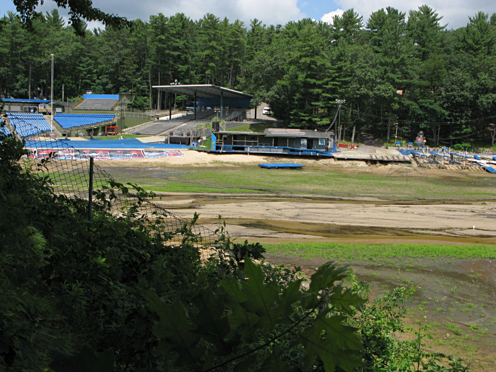
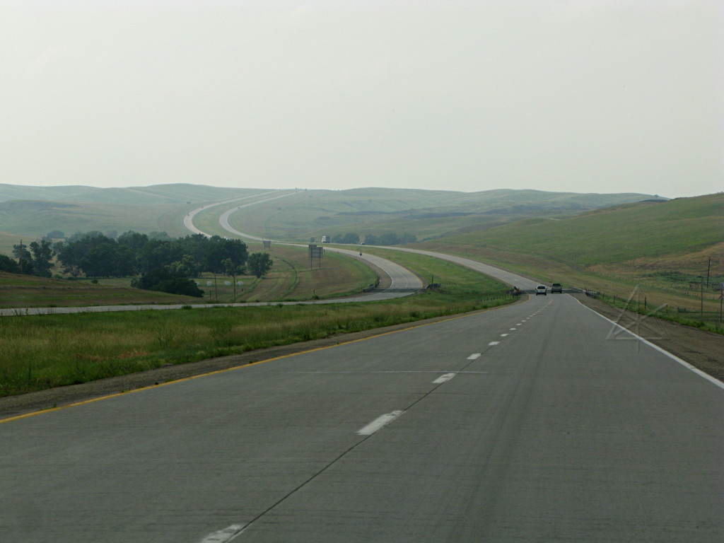
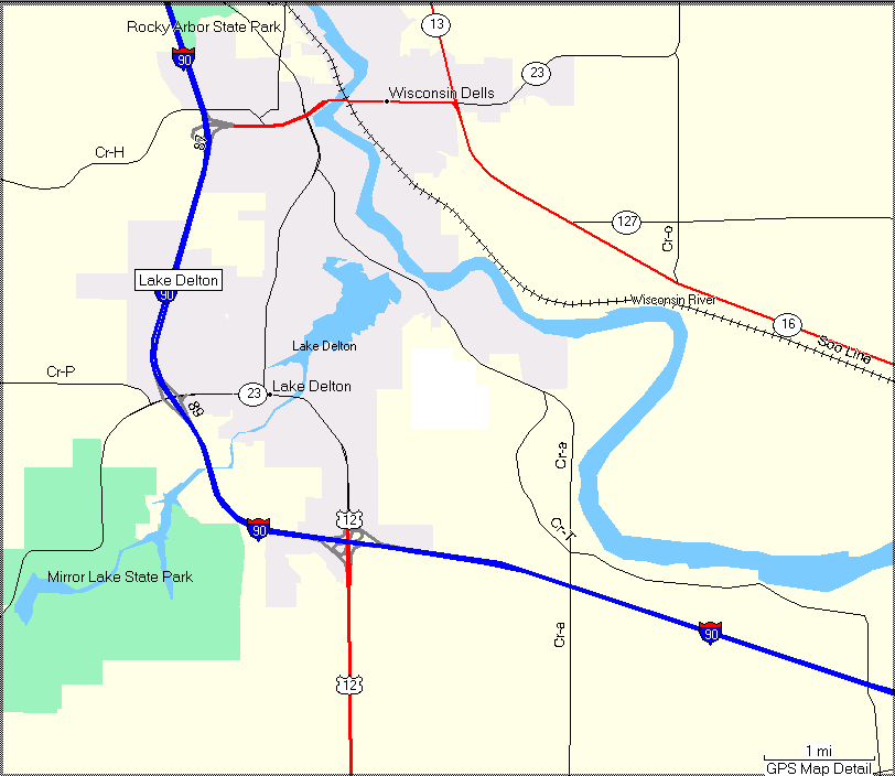
The next day I checked out, reconfigured the car a little, and began the second major phase of the journey. Here the serendipity thing started for real -- the random "come what may" wandering part, with the only goal to reach the other end of South Dakota later in the week. Some Hybridfest folks had suggested to go check out the Wisconsin Dells area as another tourist-trap sort of place that had undergone some abrupt and interesting changes recently, and it was pretty much on the way so I headed northwest up Route 12 which would bring me closer to I-90 farther up. |
|
This was along the way, and I had to run a ways out into a field to get the right angle on it. This looks more like storm damage than decrepitude, but it still captured my eye from the road. |
|
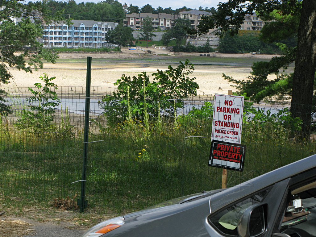
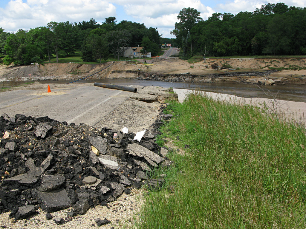
I got into the town of Lake Delton and wandered
toward the shoreline. My first hint that something was a bit wrong came
along a side road -- a temporary-looking fence with all kinds of "don't
even think of parking here" signs, and with plenty of random people pulling in
to park and gawk nonetheless. Beyond it I could see the actual problem.
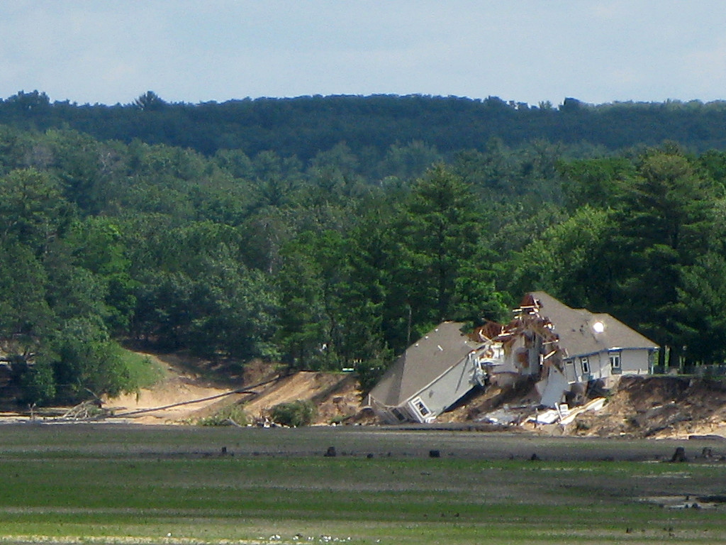
The entire lake was GONE. There was supposed to be a sparkling expanse of water here. I could already see that the waterfront resorts across the way weren't anymore. |
|
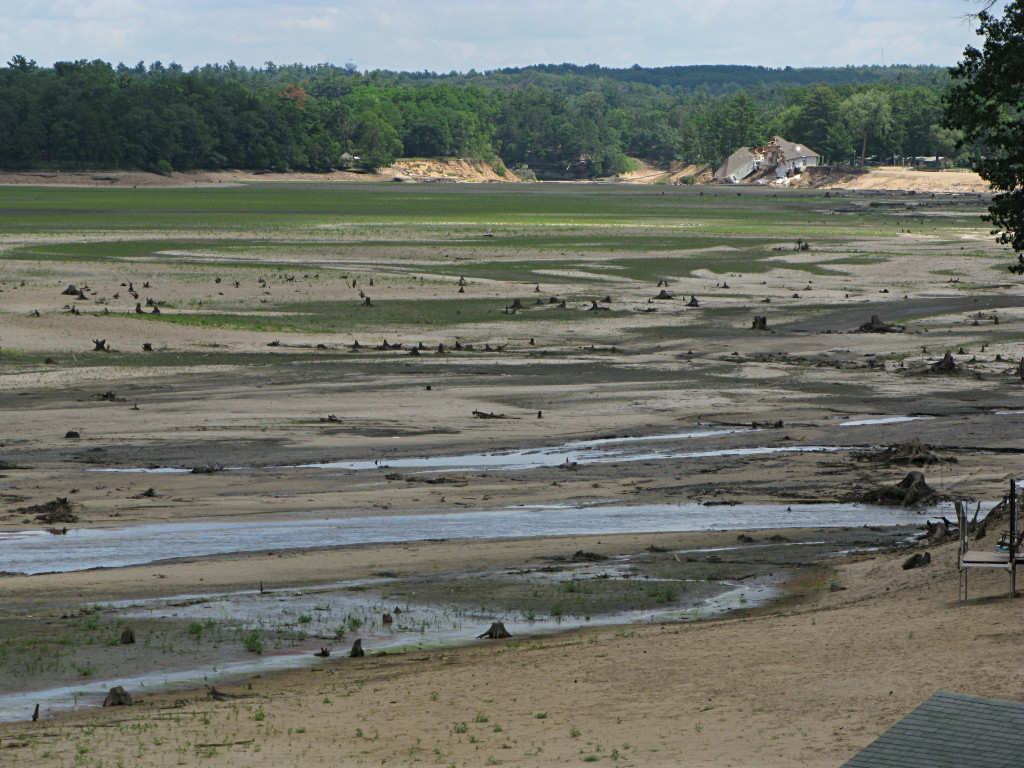
All that was left was a big mud field, with the stream channel running through
the bottom. At the far end lay the gash where the water had cut through a
narrow land bridge and emptied itself out into the nearby Wisconsin River,
during the massive floods in early 2008 that affected much of the Midwest.
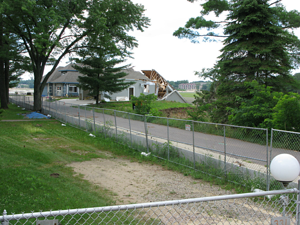
A house down near the rift had evidently not fared too well ... |
|
... as shown in this detail. Locals said there was still china sitting in cabinets in the dining room, now tilted at a crazy angle. |
|
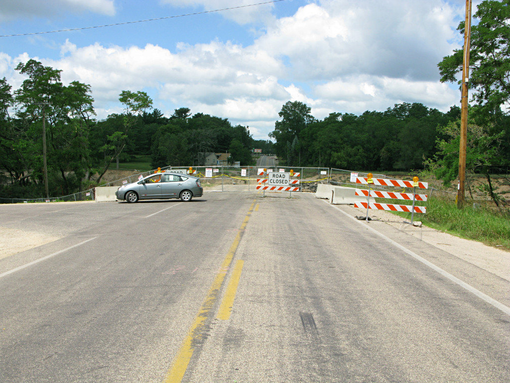
The next objective was to wander around and see how close one could get to the actual breach. I found several barriers like this set up in sort of a half-ass fashion but still leaving plenty of space to pass by, and upon seeing several other cars go around and nobody there to prevent it I kept going farther in. |
|
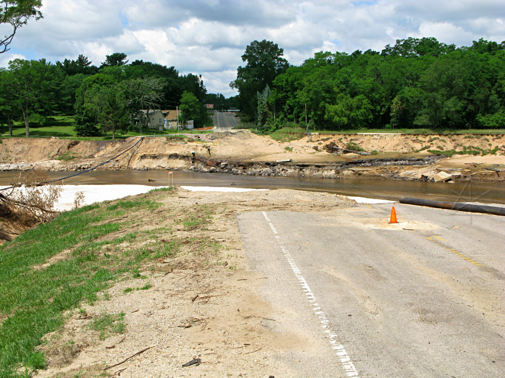
Finally I reached the real end of the road. |
|
|
| This is all that lay beyond; the road continued on the other side. | |
|
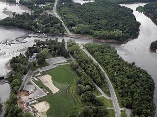
Here's an aerial shot from one of the
news articles
covering the event, taken a day after the lake had drained. All of this
had happened only a month and a half previous to my visit.
It's pretty clear from this that only a narrow and not particularly tall strip of land separated Delton from the Wisconsin River, and once the overflow got going well enough to start cutting its own channel, that's all she wrote. |
|
The other side of the collapsed house. This wasn't the only victim,
as a couple of other houses were carried completely away.
While I was sitting astride the chain-link fence to get a little more height while taking this, a police cruiser tooled into the driveway behind me, evidently observed that I wasn't actually climbing *over* the fence, and wandered off again without saying anything. They must be completely inured to tourists wandering in to take pictures of this stuff by now. |
|
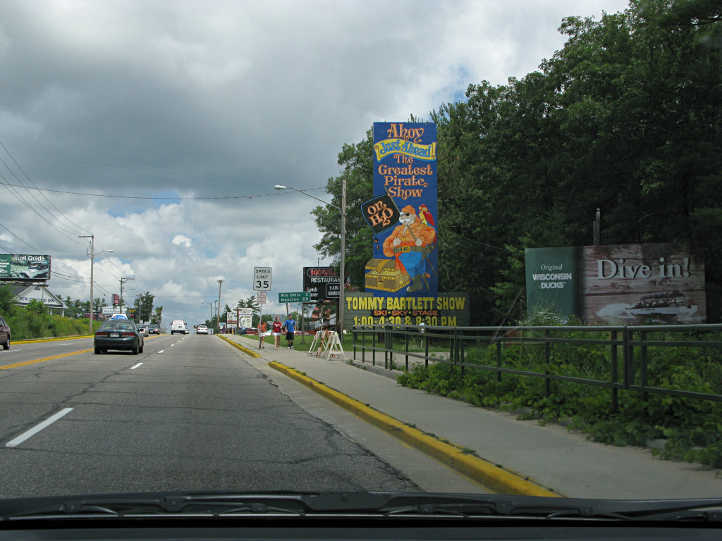
I retraced my route and went around to the other side of the lake, which took me along a more main road lined heavily with attractions of various sorts, including the barricaded entrance to this one. |
|
This is all that was left of Tommy Bartlett's empire, although he could have
probably started doing a killer series of mud pit tractor-pull contests down
here.
Ironically, I had to walk down next to the outdoor seating deck of a previously waterfront restaurant to get this, and there were quite a few customers there having lunch. To a certain extent, some places were trying to keep their chins up and continue business as usual. |
|
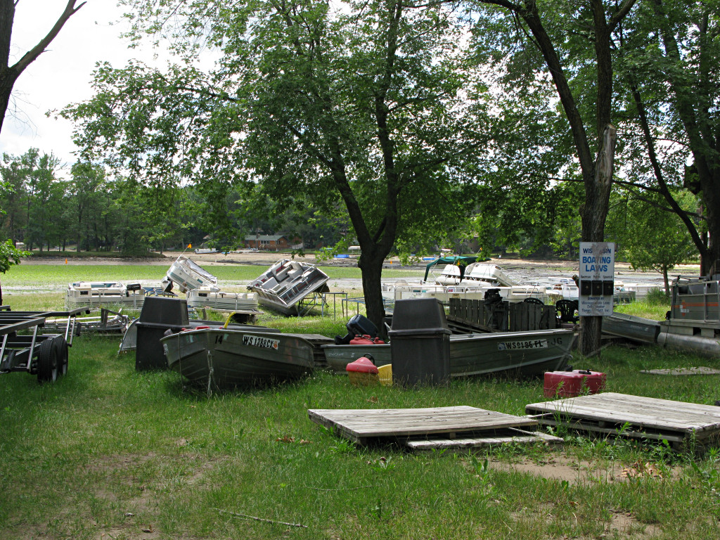
The boat-rental and watersports places weren't doing so well, however. |
|
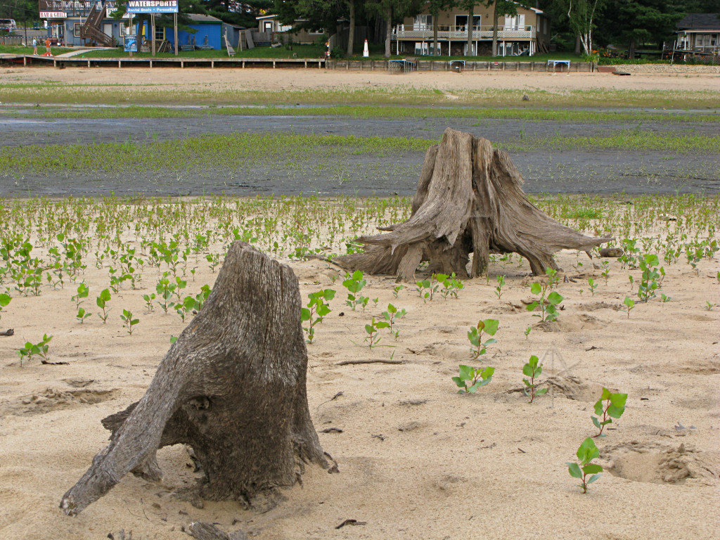
I finally found a place I could park and walk out onto the lakebed, which was already sprouting new growth. The stumps were apparently never completely removed when the area was cleared to make the lake, and just remained under water gradually rotting away. |
|
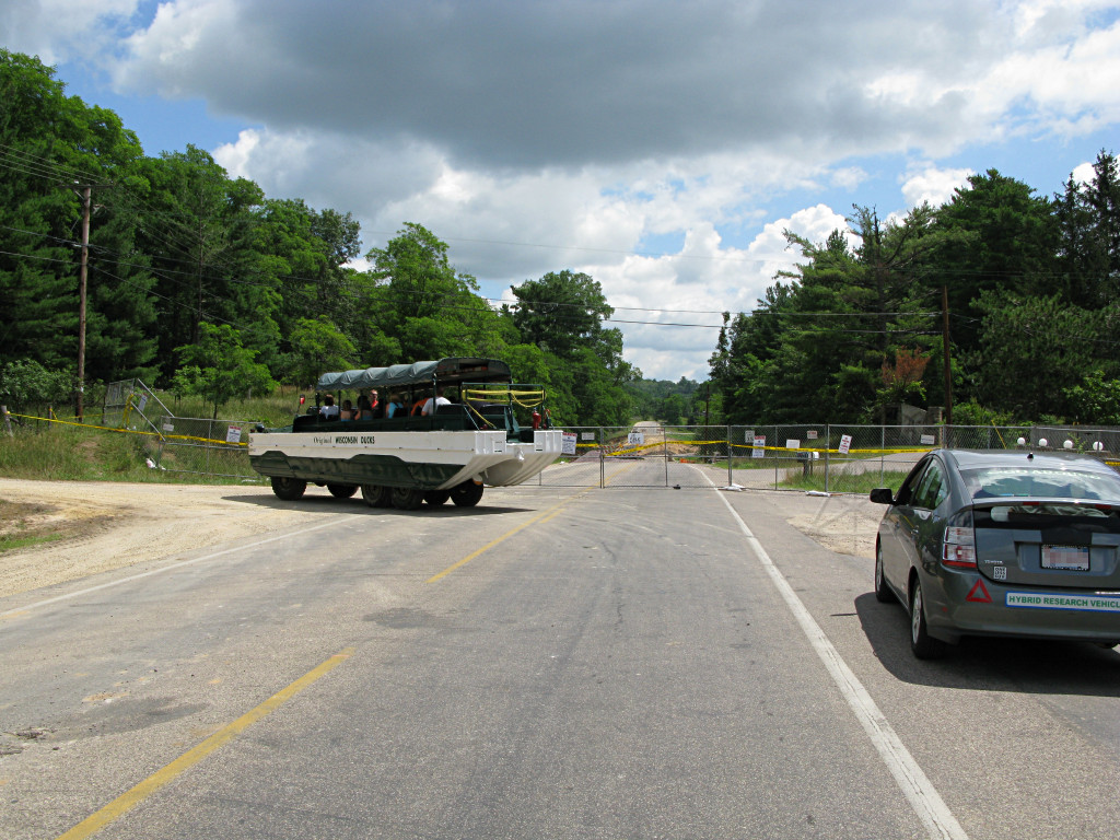
Undaunted by this minor setback, the duck-boat tours were still running.
They were taking people around to the highlights of the flood wreckage, and
telling riders the whole story over the PA. As they came past me and paused
at the turn, the speakers were loud enough that I was able to use the camera's
sound recorder and grab some clips of what they were saying. Here are
duc1.mp3 and duc2.mp3
for your listening enjoyment, with the caveat that there's a little bit
of digital clipping here and there as the original levels were very low
and had to be bumped up quite a bit during conversion.
I am bemused by how the local Wisconsin accent seems almost Canadian. |
|
It's going to take the area quite a while to recover from this, but efforts
to rebuild the bank and roadway are apparently already underway. It's somewhat
ironic that the breach didn't happen at the existing dams that created the
lake in the first place, but at the highway embankment that had otherwise
been thought of as a solid, unyielding wall.
I continued up toward Wisconsin Dells itself, and found plenty more tourist traps that don't depend on the lake other than to potentially increase the customer base in the area. At the intersection of two more major roads is the Mount Olympus amusement park, complete with a Trojan Horse and a fairly large wooden roller coaster. |
|
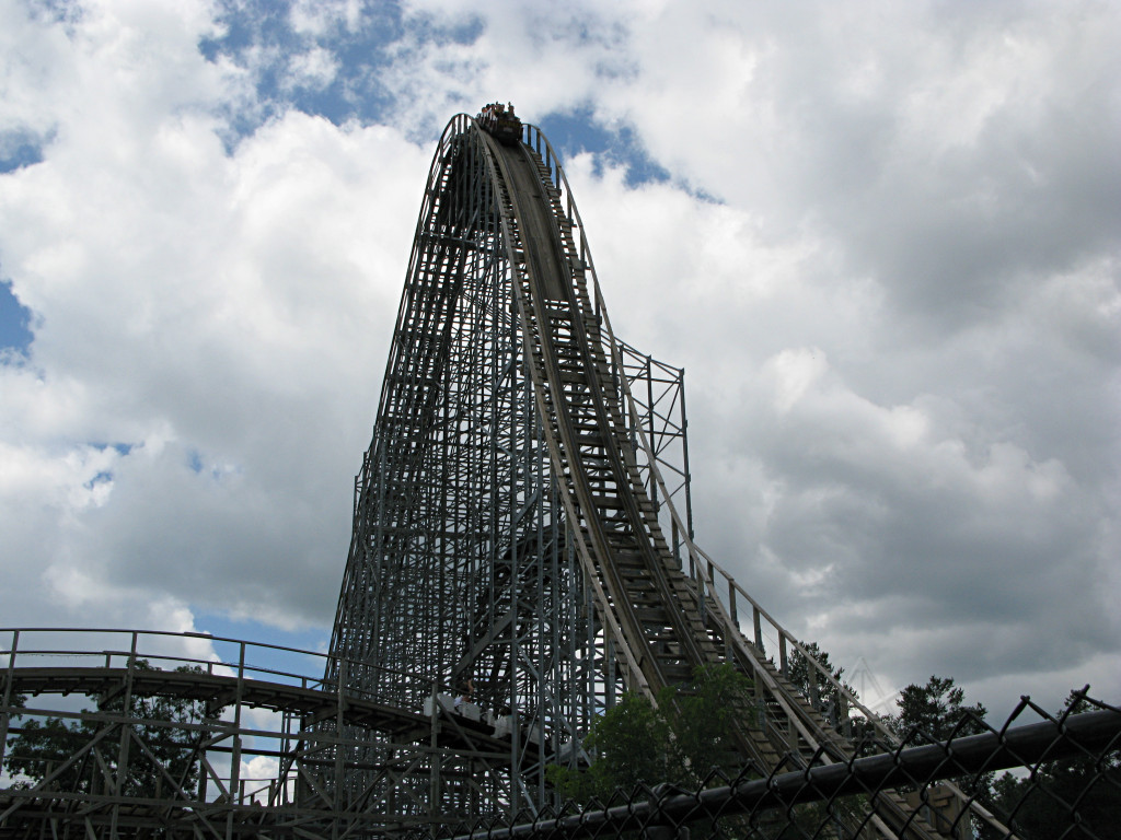
Here's the first drop of the coaster -- not anywhere on the height scale of Cedar Point, but one may notice that it hasn't really leveled out yet down here near ground level. |
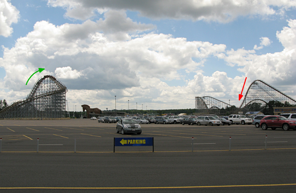
|
There's a good reason for that. The first drop goes underground where the
red arrow is, through a long tunnel under the parking lot, and pops out at
the green arrow! It goes around a little tangle of track at the left and then
dives back under the parking lot to return to the remainer on the right.
It was tempting to go in and do the ride, but the day was starting to wear on a bit and I didn't get want to get too much more ratholed as I already had wandering around the lake. |
|
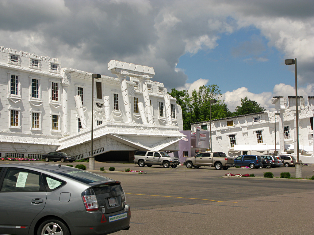
Right next door to Olympus is this, some sort of fun-house entitled "Top
Secret", presumably involving some weird theme of an overthrown and
overgrown White House. Personally, I find this a much more appropriate
motif with a Prius sitting in front of it, and the clouds shaped in a way
that makes it look like the wreckage is still smoking.
I had overheard one of the duck-boat drivers telling his passengers about this, "don't bother -- it stinks". 'Nuff said on any curiosity about going inside. There are some similar sentiments and inside pictures floating around on the net, too. |
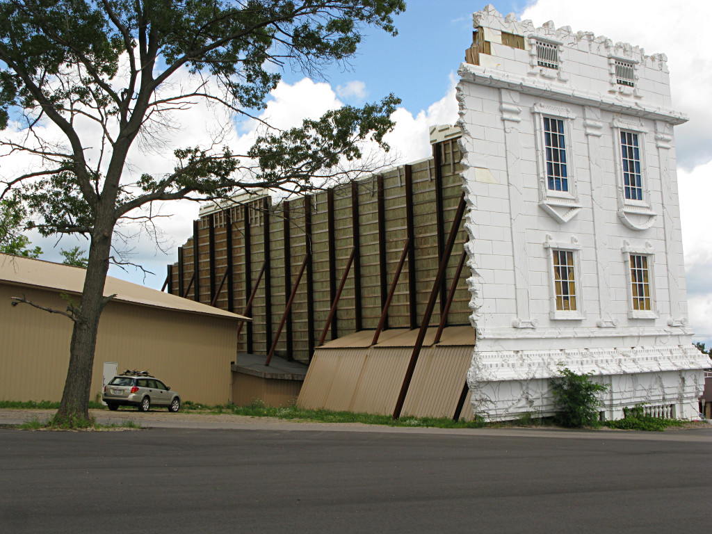
|
Even more ironic is that this White House has no interior substance -- it's just an empty shell, a facade, a total sham designed only to separate people from their money. And this is different from the other one how? |
|
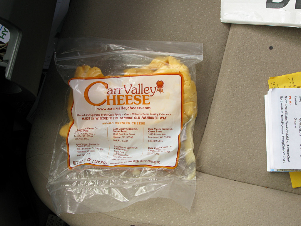
I figured since I was in Wisconsin, I should experience the cheese. I found this in a random gas station, as a possibly mistaken impulse-buy on an empty stomach. Note that it doesn't say what *kind* of cheese is in the bag, and the fluid in the lower corners ... well, it turned out to be not quite cheese yet, i.e. the "squeaky" cheese curds that would one day hope to grow up to be some variety of cheddar. They were incredibly bland but at least some degree of sustenance, and became lunch. The total lack of type identification still puzzled me, however. |
|
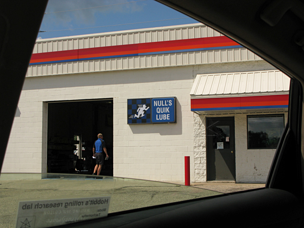
I continued northward out of Dells and got onto I-90, but got off again fairly soon as I reached Mauston, home of a store listed on the cheese package. I figured I'd stop in and ask them about the curds. While sorting out which way to go I swung into the driveway of this place. Would you bring your car here, and possibly not have your oil changed? Actually, the guy walking back into the shop had come out to see if I needed help, seemed pretty clueful, and was rather curious about the car and hybrid stuff. He's got one of my flyers in his hand. |
| I finally did find the cheese outlet and got not only the story on my rubbery proto-cheddar, but also learned that one of Carr's major cheese factories is also in Mauston and offers tours. Aiieee, yet another side-trip I could make! But I declined at this point, and got back on the highway to keep rolling. It was time to quit goofing around and start putting some serious miles behind me. I wanted to at least make it into another state before nightfall. |
|
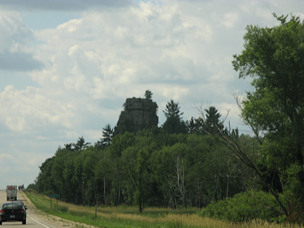
A strange isolated [and in this case, blurry] tower of rock next to the highway. There was a bit of bizarre terrain here and there in western WI, or at least I thought so at the time, having relatively little idea of the wonders that lay much farther ahead. |
|
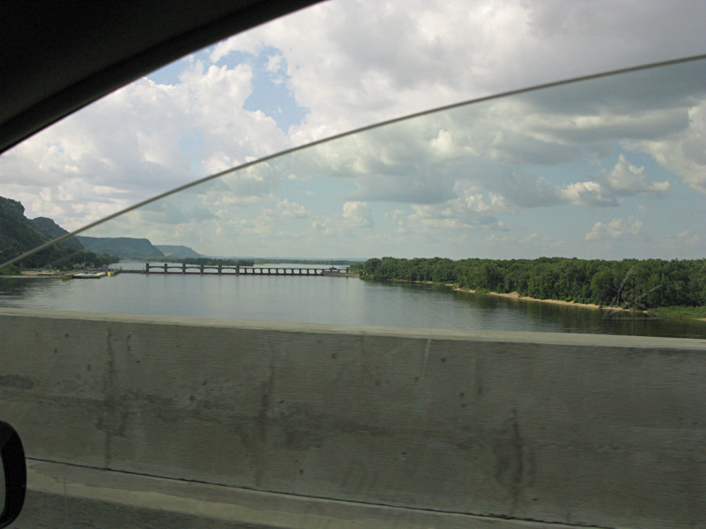
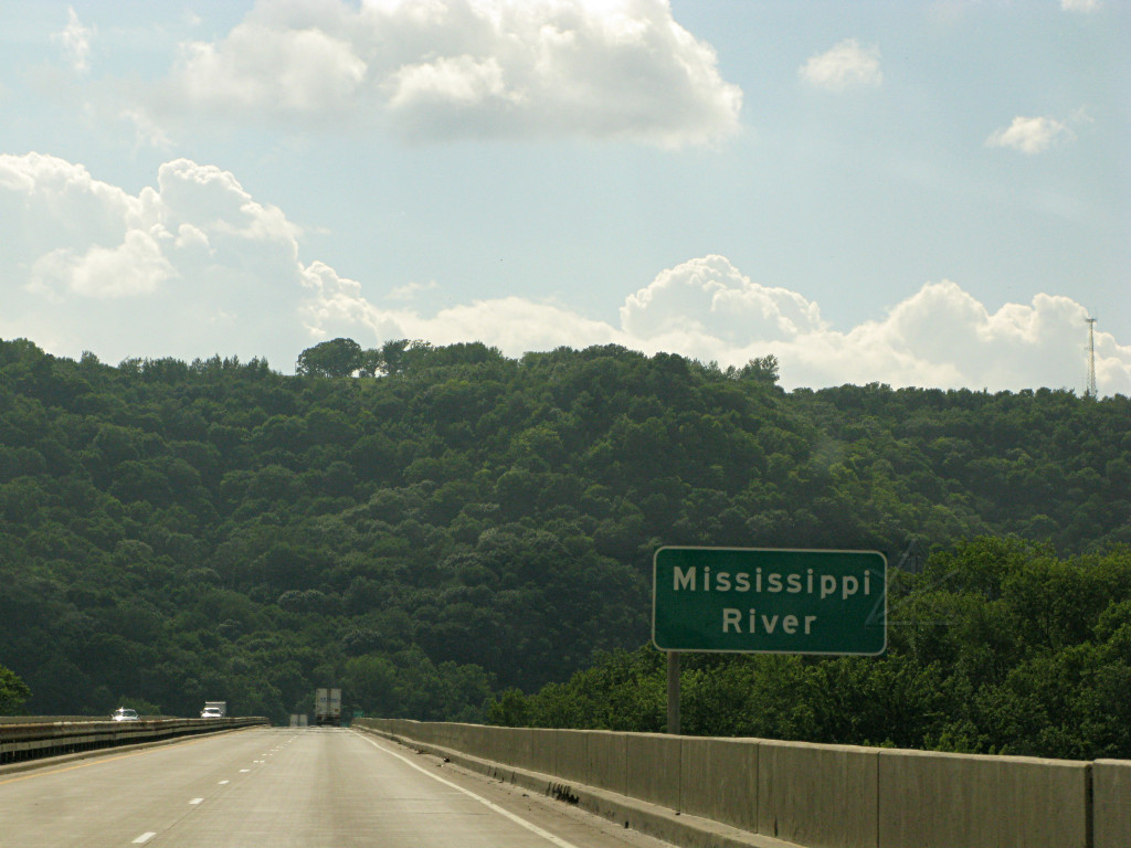
The Mississippi was sort of a significant landmark in my mind, as I had never
driven west of it or for that matter possibly even *seen* it other than from
the air. As I looked northward along the river here, I couldn't help thinking
how convenient this nice highway bridge is, where the colonists back in the
day would have likely arrived at the banks and thought "oh crap, now what?"
Now, notice the height difference between land on the west side and the east. |
|
I had not descended any significant amount to get here, but was facing a bit of a climb on the other side. Most of the land west of, say, Pennsylvania seems to be at an average of 600 - 800 feet above sea level, fairly consistently all the way across from Ohio to here. [That's one minor reason my shorter return trips back to home at 50ish ft ASL tend to return slightly higher MPG; the other is the prevailing westerly wind.] So I began wondering if this was just a quick ridge, or a significant elevation step. |
|
|
|
I could see that the interstate bends sideways along the hill for a gentler
slope, and just for yucks I decided to exit and explore around a little and
see if I could find a good picture-spot.
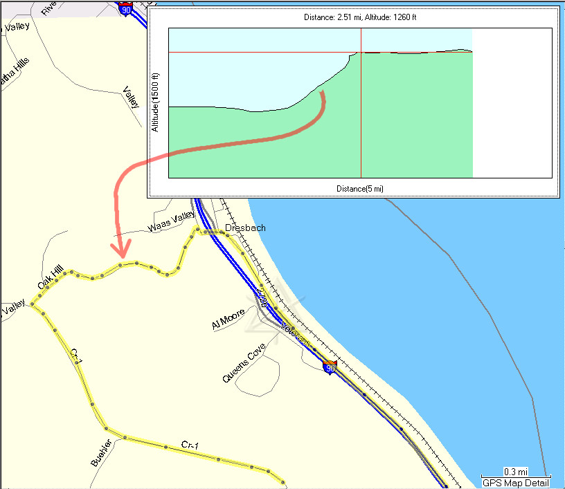
Soon I found a minor backroad that turned into gravel and made a steep climb,
almost straight up this thing! Near the top, at the steepest part about
where the map says "Oak Hill", I came up behind a bicyclist on a
fully-loaded touring rig, huffing his way up this same hill in his dead-lowest
granny gear. The one-lane, heavily crowned gravel road wasn't wide enough for
me to even think of passing him so I simply
came to a stop right there and waited for him to gain a bit of distance.
Getting moving again was a little interesting, requiring a feather-light
touch on the go-pedal and hoping the wheels wouldn't spin too much. I was
strongly reminded of some
other gravel roads that played
a bit of hell with the Prius traction and over-rev control.
By going this way I wound up doing the same altitude rise in a fraction of the run distance that the interstate would have, but probably having a lot more fun. And to answer my own question about elevation, the baseline of the landscape *does* jump to 1200 feet here and stays. | |
|
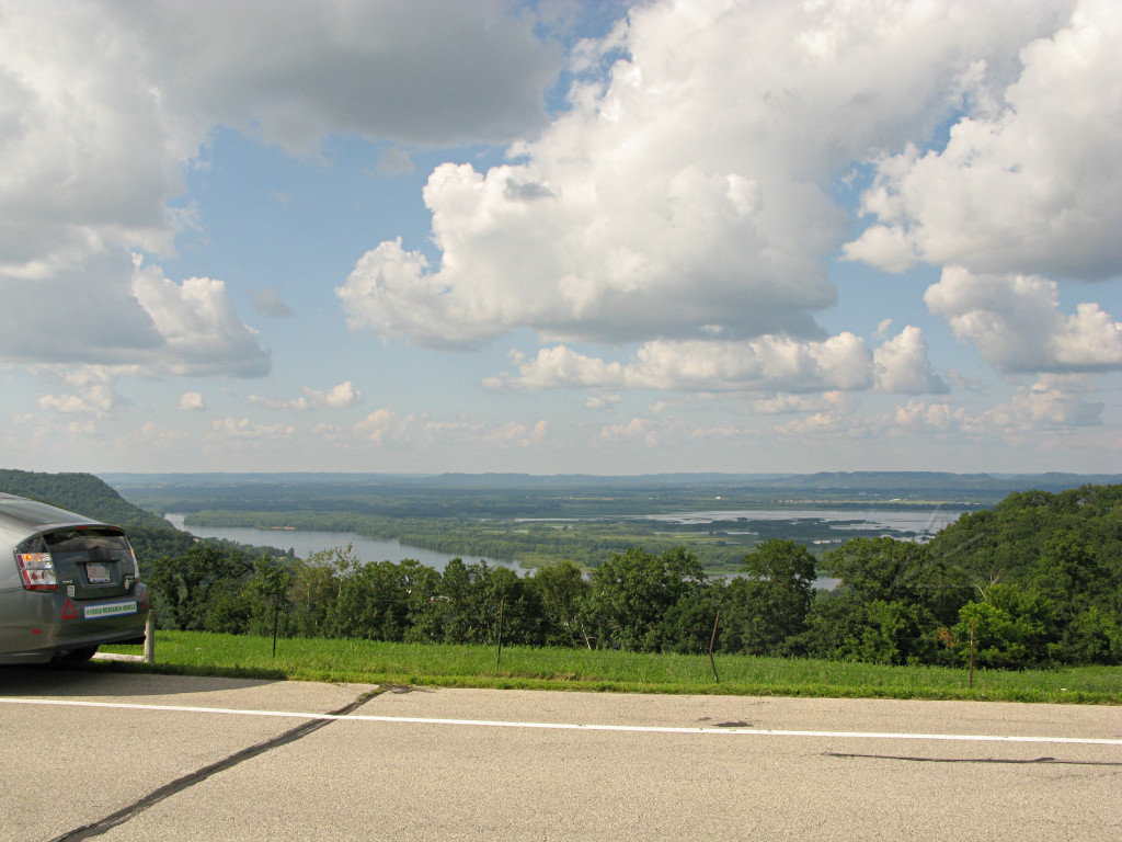
The gravel road, which I almost expected to dead-end with no place to turn around, eventually opened up onto a county highway and a short backtrack toward the river yielded my nice vantage point overlooking it. |
|
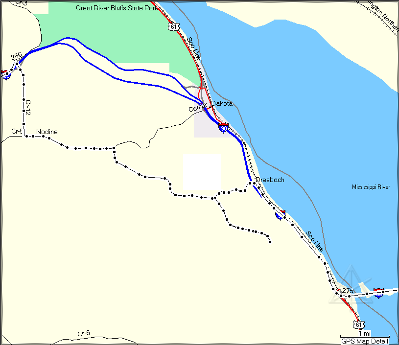
County Road 1 here intersected with a couple of others as I worked my way back
toward the interstate, somewhat blindly as none of this was detailed on the
GPS. [See larger "mish1.gif" above]
This tree said only one thing to me: "Duh, install a wind turbine here." |
|
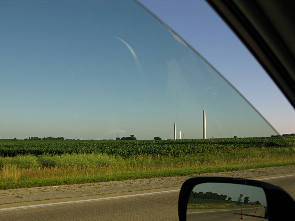
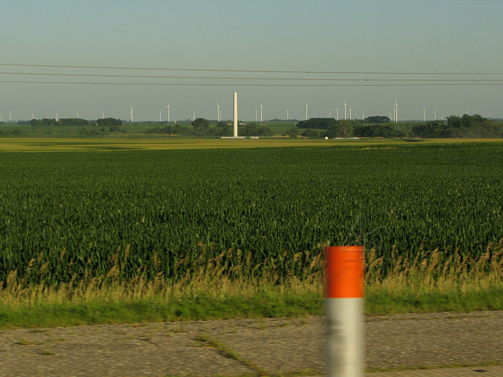
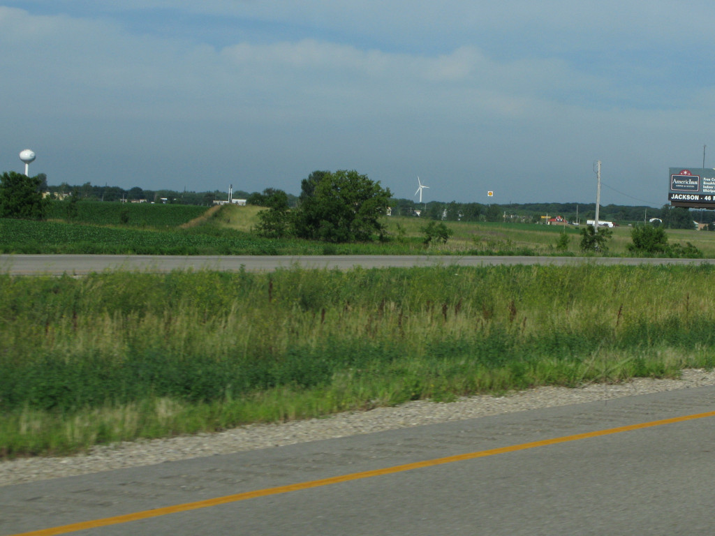
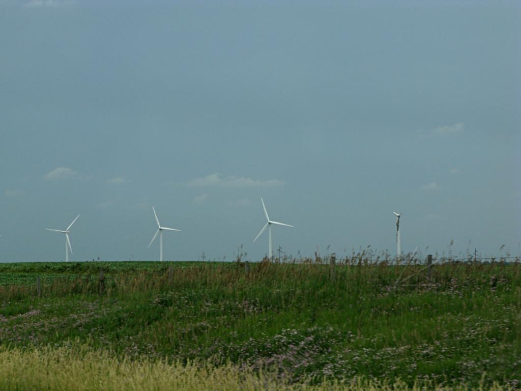
As I settled in for the long run across Minnesota and neared the town of Austin, I began to spot some strange towers in the cornfields. Some newer cell-phone towers are designed like this to hide the "ugly" 3-sided antennas, but these couldn't be cells as they were way too close together. |
|
In the next couple of miles I got my answer.
Windmills! Lots of them! |

|
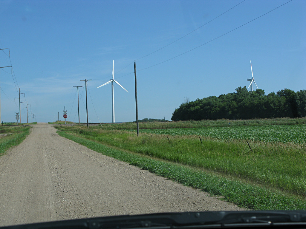
I discovered that afternoon that Minnesota in fact has some serious clue about wind energy, as I continued seeing evidence of large windfarms almost all the way through the state. That little leaning tree was speaking the truth about the locale, as in fact does the map from this article that I dug up later on. I had apparently entered the country's central "wind belt". |
|
I had never seen a windfarm like this in person yet -- an isolated turbine here
and there, sure, but not this scale of deployment. It was really inspiring to
find it, and realize that yes, people *are* thinking big and seriously about
building this infrastructure. I had been wondering for a few years now why
I didn't see them planted among cornfields in other areas, like, say, Ohio??
in open space where there's usually lots of wind and whose small footprints
would remove almost no growing room. And frankly some of them could *still*
be cell towers with the mere addition of antenna arrays about halfway up the
masts, thus getting triple duty from the same real estate.
But by now it was getting quite late in the day, and I eventually took one of the exits listing "camping" to find somewhere to shower and sleep. |
|
I wound up in one of the state parks, which as a general rule have pretty nice
campgrounds. See? Still up around 1200 feet here, and everything since the
river had been pretty flat.
The GPS basemap gets the location of the lake a bit wrong, making it seem like the car went aquatic for a bit ... |
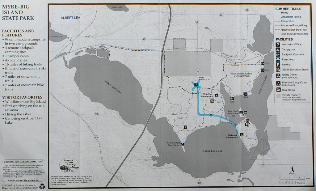
|
... but it's not a duck-Prius; there's actually a big island in the middle, named [oddly enough] Big Island. |
|
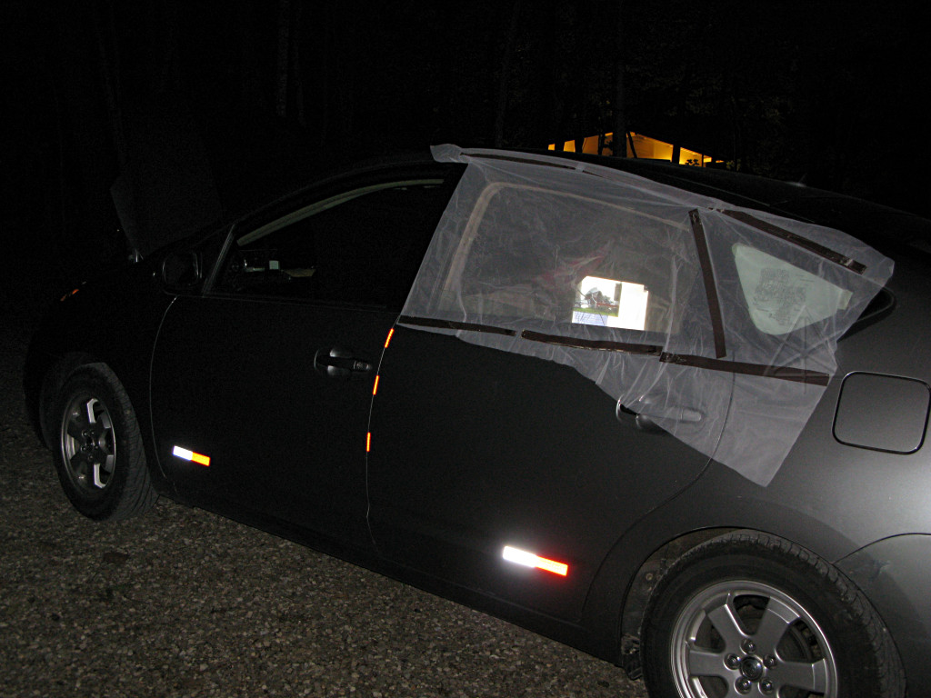
A fairly quiet spot but still reasonably close to the shower building in the background, and after a refreshing visit to same, now comfortably set up for the night -- window screens deployed, "remote office" booted for picture download, bed waiting. On several of my overnights before going to sleep I tried to make some headway on processing the pictures to date, but it always seemed like I couldn't concentrate and fell over into bed way too early to get very far on them. This evening was no exception. |
|
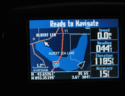
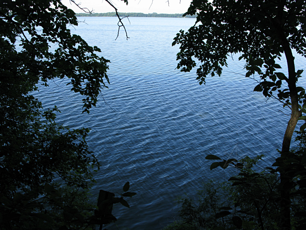
I got a brief look at Albert Lea Lake on the way out the next morning ... |
|
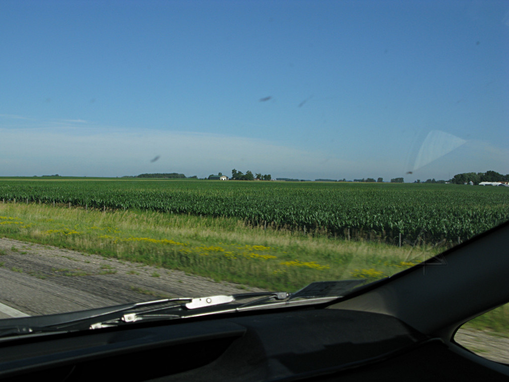
... but soon found myself back to cruising through endless cornfields. |
|
These aren't quite decrepit enough for the series, but wait another twenty or thirty years. |
|
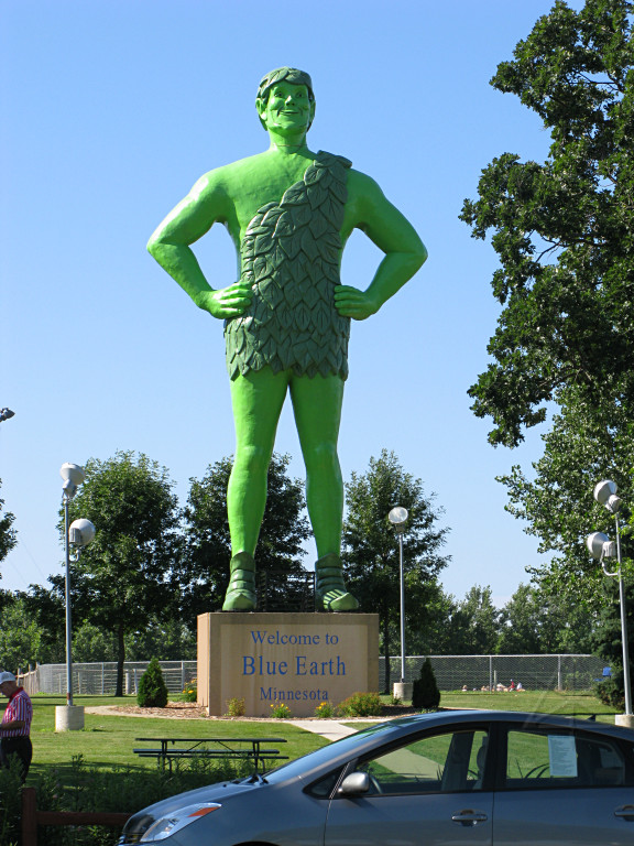
In the town of Blue Earth, I found the Jolly Green Giant. |
|
Why did I pull into here? Not just for the amusing name, but I had also spotted at least one wind turbine that looked to be within visiting distance from the highway. Perhaps this little town was thinking more deeply about our blue earth as a whole? |
|
It took a while to sort out which little gravel road would actually go out to the correct field, but I gradually worked my way nearer. It seemed to be a relatively isolated pair. |
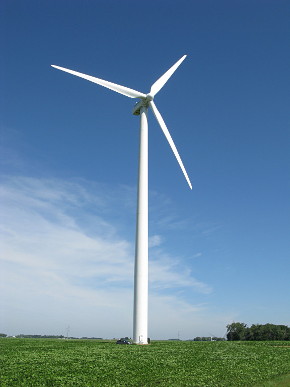
|
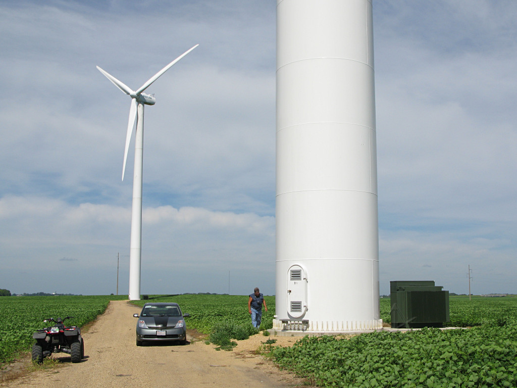
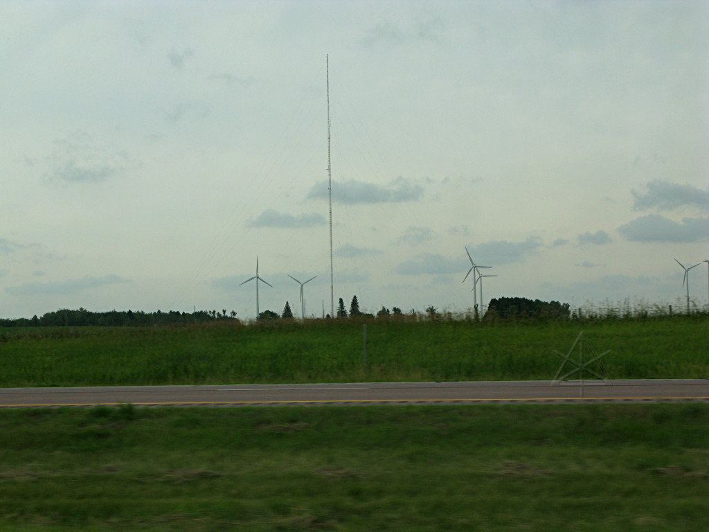
And finally I reached them. There's the car is parked at the base, for scale. These things are BIG -- on the order of 240 feet high, and impressively tall when you get near them. |

|
| This yields the perfect image outline to use for reworking a typical redneck bumper sticker. THIS is how Americans should be thinking about their pride and patriotism, rather than sticking warmongering mob-hysteria slogans and yellow ribbons onto their fat gas-guzzlers and thinking that's some twisted expression of "freedom". |
|
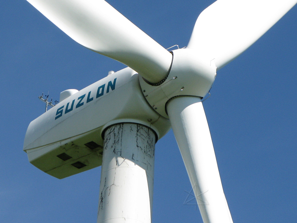
Detail of the generator head. There's quite a bit of weather instrumentation
built onto the nacelle, and my guess is that the rails between the blades are
what workers clip their fall-arrest gear into.
The manufacturer has an obvious URL. |
|
I had walked some distance away from the car to shoot this, and as I stood
there I heard a little puttering behind me and two guys came along the road
on ATVs. Ut oh, I thought, maybe they're the landowners and they think I'm
out here up to no good...
Before "Dueling Banjos" started playing too loudly in my mind, they pulled up and we started chatting. Turned out they were just a couple of locals who had decided to pop out for a quick visit to the turbines that day too. They were pretty amused that someone all the way from Boston had taken the time to hop off the interstate and semi-offroad his way out out to the middle of this field. After it became established that I wasn't going to continue my trip nursing rock-salt shotgun wounds, they also told me a little about the history behind this pair of machines. Apparently a local resident with a bunch of extra money had decided to fund them all on his own, and had arranged for them to be built at a cost of about a million apiece [and undoubtedly recurring rent to the landowner as well]. But people in these areas are getting more into this, wanting to do the right thing, and apparently Minnesota is under a directive to have at least 20% of their energy be from renewable sources by a fairly close-in date, like 2012 or sooner. So obviously there's a big push going on. I mentioned what I'd seen east of Austin, and one guy said that if I had driven through the backroads over that way I would have seen huge *piles* of windmill parts stacked up. It was really tempting to go back, but I figured I'd look around on the net later and find more info about it. |
|
We all went back over to the tower base to poke around a little and so they
could have a look at the car, and I gave them a couple of flyers. We must
have talked about various types of energy stuff for a good 20 minutes.
While we did, every so often the swish of the blades would change and we'd hear a little motor noise up in the head, as the pitch adjusting mechanism evidently furled the blades to momentarily remove the load from them. Then the whole head turned just a little bit, and the blades would speed back up and resume the previous gentle swishing. The wind *was* changing direction slightly while we were there, and at a wild guess I would say that the control systems don't want to turn the head while under full load to avoid stress from various gyroscopic forces. I assume that all of these are under extensive remote control from elsewhere and have full data networking run to them. These aren't your kid's pinwheels anymore, by any stretch. |
|
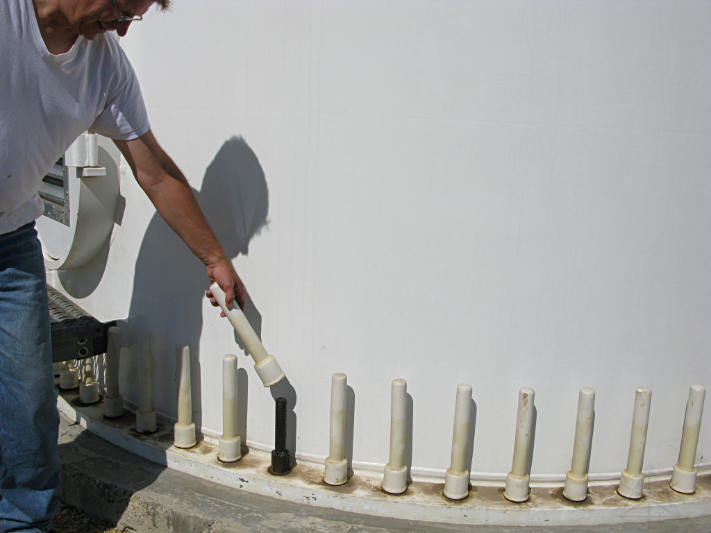
It's pretty amazing that the narrow footprint of what holds the tower down to its base doesn't get overcome by the axial load against the turbine with such a huge lever arm up into the air. But this is all there is to it. All the hold-down bolts have a heavy coating of grease and then these little weather condoms put over them, to discourage corrosion. This seems vulnerable to theft and vandalism, and the guys said that to their knowledge people weren't messing with the windmills too much at this point but that might change as they became more common and mainstream. I suppose most of the installations will need little fenced-off corrals around each base like they do with radio towers, especially if they're in livestock fields. With a data network already linking everything up it wouldn't take much to add a couple of infrared-enhanced webcams to help catch miscreants. |
| But people react strangely and often stupidly to anything new, witness all the unfounded resistance to the Cape Wind project back home. Farmers have objected to harmless power transmission lines run across the land; there are even songs written about the struggles over new infrastructure -- in Minnesota, even. But this setup is apparently a privately funded project and an agreement with a private landowner, and other than the grid hookup there isn't any part of it that needs external approval. And frankly, anyone who thinks these towers are an eyesore needs their sense of aesthetics ripped out and replaced. | |
|
|
|
As I got back to the highway and continued westward, there was quite a lot of
evidence that this same scenario had played out in many other places. It
was all really encouraging to see -- my first real-life glimpses of people
actually *caring* about this stuff and backing it up with installed base.
What's kind of ironic is that I could have gone much more locally to check out an installation in western Mass that documented the whole thing in faqs and pictures, but the efforts back east are largely onesey-twosey deals and nobody's really building large collections of these things yet. | |
|
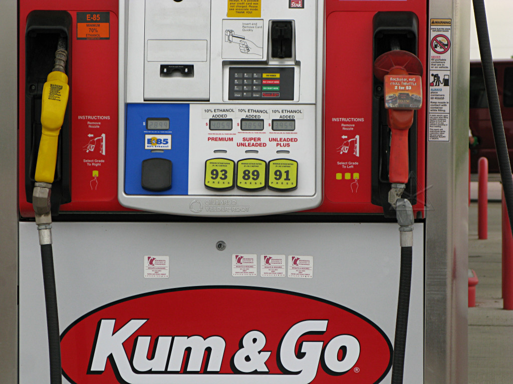
Back in the world of nonrenewable resources, I eventually had to tend to
some business. I'm not sure which is more disgusting here: the name of the
place, or the fact that they have an E85 pump. Well, I was in the middle of
the corn belt... But more interesting than that is that they appear to have
no 87 octane at all!
I thought "screw this" and drifted across the parking lot to the other, older and more run-down looking gas station with the sign outside proudly displaying "independently owned and operated!" where they had 87 and good coffee. Evidently the real story and motivation behind the other chain is "kum and take over" to squeeze out the local established businesses. Heck, if it works for Wally World then that makes it okay, right? Bah. I had slowly risen to 1530 feet ASL at this point, too. |
|
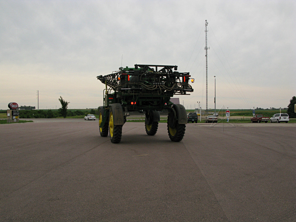
I probably could have fit the car completely under this for a picture, except that the guy driving it was just leaving. The locals evidently take large farm equipment right down the roads to fuel them up on a regular basis. |
|
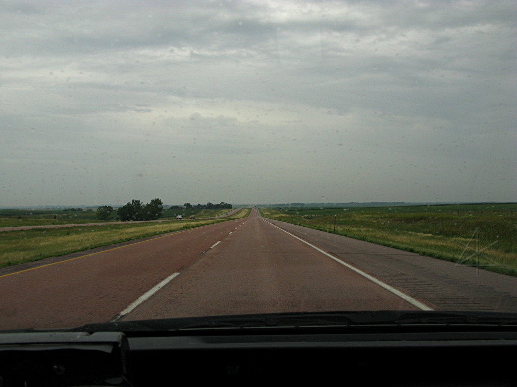
I finally crossed the line into South Dakota, and began to encounter a bit
of rain.
And a posted speed limit of 75, too. eep. My unchanged 60-65 wasn't a problem, though, since the spaces were very wide open and traffic infrequent -- anyone going faster had over a mile to plan their pass. Not that that means much in some cases, of course. |
|
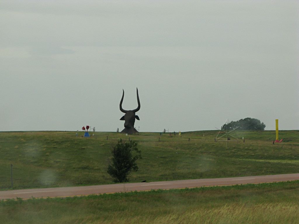
I spotted a bit of Strange Lawn Art sitting out in the fields. |
|
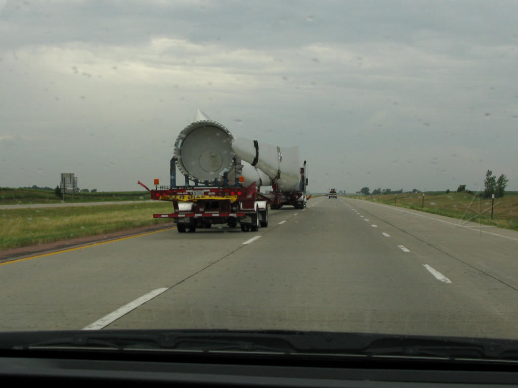
At one point a truckload of windmill blades roared past me. I have no idea
where it was headed, since I didn't actually see any more windfarms all the
way through South Dakota.
But this lends more perspective to how large these parts are. They look delicate and graceful in the air, but there are plenty of big heavy steel components in one of these things. |
|
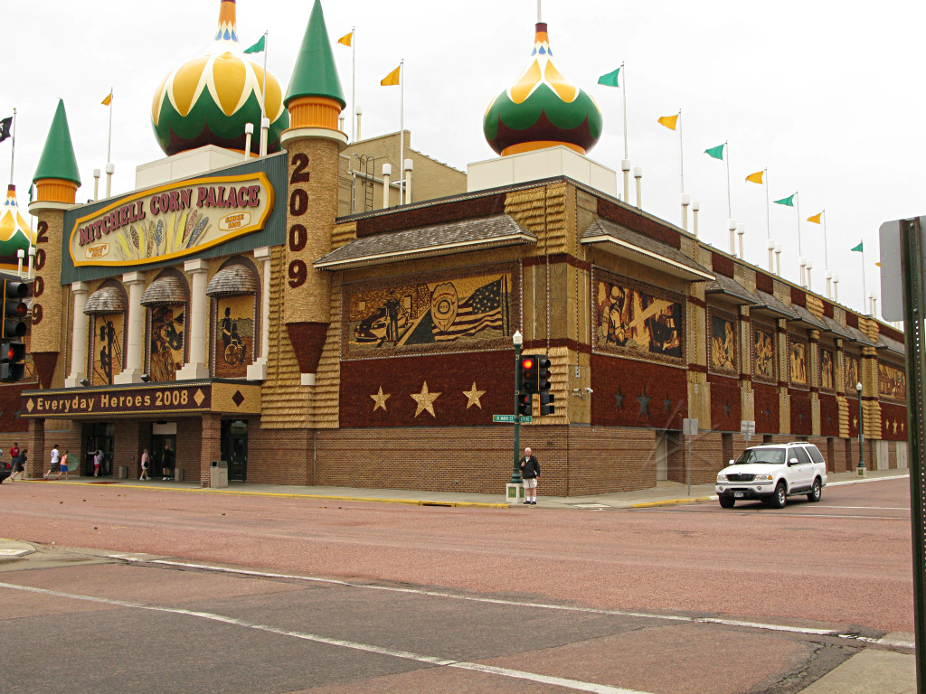
I was heading for Mitchell, SD at this point, having read something about
a fabled Corn Palace there. I began to see billboards for it 150 or more
miles out, sort of like that South of the Border place in the Carolinas.
The wind had shifted around a little and seemed to be quartering from the southeast against my left rear, but not helping my mileage much which was stubbornly staying down at 57 and change. Dunno. At the overall speed I was going it did make sense in the expected tradeoff around the optimal "60 @ 60" crossover point where MPH meets MPG in this car, especially with a pretty much guaranteed E10 fuel content out here. |
|
Soon I got to Mitchell and found the Palace. It's not actually made from corn. It's got plywood panels around the outside onto which is nailed various artwork constructed from corn, and it's pretty much confined to these two sides of the building while the other two sides are blank walls. But each year there's a different theme of panels designed and constructed. |
|
It's really a fairly generic function hall, that can be used for trade shows, exhibits, stage productions, and apparently basketball games. Today they were having some sort of jewelry / tchotschke sale. There's more corn artwork on the inside that tends to stay in place much longer, since the birds come and eat much of what's on the exterior within the year that it's up. |
|
Here's a detail of how the art is constructed; sort of dot-matrix but with a little more possibility on angles. |
|
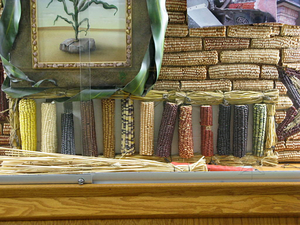
This is their palette of colors, and it's apparently almost all grown by one farm nearby. |
|
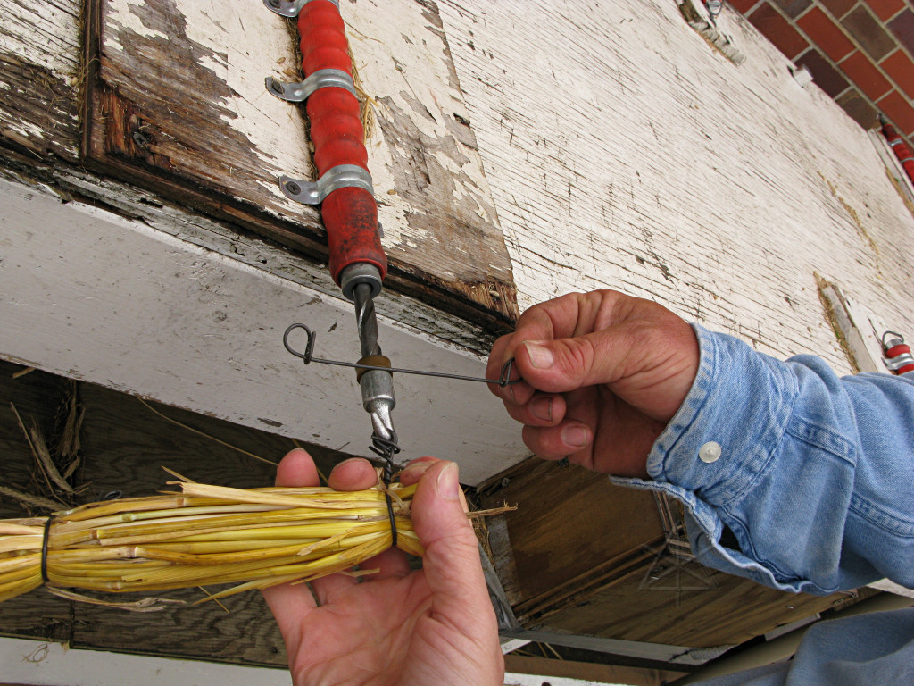
I found that out along with several other internal details. I simply went
back outside and walked around the back of the building, and found a door
standing open into what looked like shop space and a guy who seemed more than
willing to answer questions. It turned out he's the fellow who heads up all
the construction and installation of the artwork every year! When I asked
about the tables back there with what appeared to be safety-wire twisters
strapped down to them, he showed me how they use those to rapidly bind up
these "straights", as they call them, made from straw. That's my hand holding
the bundle and hooked to one of the binding wires, and his hand holding one
of the baling-wire twisties they use.
In his relatively short tenure to date he has also done a ton of optimization of how the artwork gets constructed. They used to use fairly clumsy hatchets to chop off the corncob ends, for example; he went out and bought a couple of chop-saws that makes that job much more fast and accurate. He also has to make a few changes to the artists' concepts so that they'll be practical to deploy on the wall, but is trusted to do that in a way that retains the sense of what the artist was trying to express. |
| It's sort of amazing what you can discover about a place if you walk around to where its loading dock or equivalent is and ask a few questions. The people who do the real work on the infrastructure, almost regardless of what the particular organization is, love to talk about what they do once you get them started. | |
|
Okay, having seen the much-ballyhooed but somewhat anticlimactic Corn Palace, I continued on and eventually crossed the Missouri River. This is from the rest stop right before it, which didn't afford a particularly great view, as the rain earlier still had the humidity pretty high. |
|
And still the road continued on, through miles and miles of rolling prairie.
Think about that word for a second, possibly in the context of "prayer". My new working definition of "prairie" means fervently wishing that the trees would grow back. The farther west I kept rolling, the fewer and fewer trees I saw and as an eastern boy from the dense New England forests, this was beginning to really bug me. Sure, there were little clutches of foliage here and there but for the most part, everything I could see mile after mile was bare except for this endless grass. |
|
I finally exited into the little town of Presho SD, with the idea of finding
a place to overnight -- it seemed to have at least one RV park which was
actually visible from the highway. Few if any trees, though, and with the
humidity and hazy sun that afternoon I seriously wanted *shade*.
I explored around a little. Presho is another one of those places where you'll have to stop for people driving full-size combine harvesters right down the main drag. But the rest of the town seemed relatively inactive. |
|
With some half-formed fantasy of going off the beaten track and maybe finding
another place to spend the night, I headed a couple of miles out of town on
a local road to the north. It didn't take long to realize that this would be
totally futile, and while the amber waves of grain here were fine in their
own right, I was in the middle of frickin' NOWHERE.
Like I almost expected to see Clark Kent and his mom standing up on top of the next rise. I gave up and went back to the RV park, signed in, and headed for the shower. Where the mosquitoes had been almost unbearable back in Wisconsin, Presho seemed plagued with those little red-eyed biting flies that sting more and are faster and more elusive. I managed to rig my screens without letting too many of them into the car, and had to re-angle the whole car in the RV slot so the persistent south wind would actually circulate air through and take away the heat. And again, efforts to work on trip-log material, beyond pulling the day's pictures off the camera, soon yielded to the need for sleep. |
Go to Part 3: South Dakota, Black Hills
_H* 080930